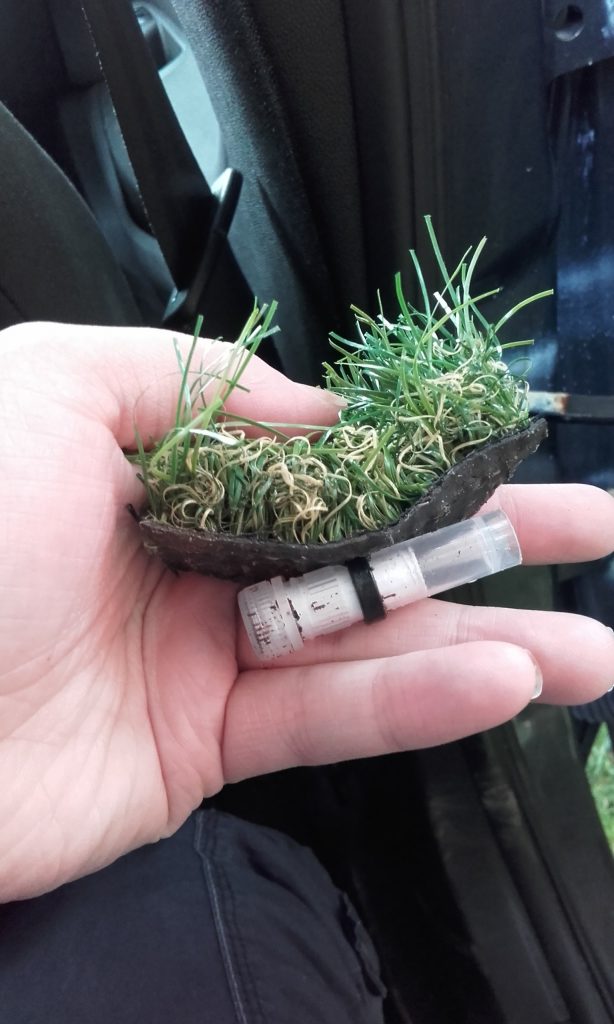
GC9B20Z Stop At The Estuary by KANDRANDD Traditional D1.5/T1.5 GC9B21C Diwedd Marw by KANDRANDD Traditional D3/T2.5
GIFF 2021
Lights, Camera, Action! We are excited to announce that the Geocaching International Film Festival is back for another year of geocaching film fun! We hope to be hosting the film show on Saturday 20th November, times and venue still to be confirmed.
Osprey Update
I don’t know if you have been following the Glaslyn Ospreys but it has been quite a week with another female osprey, KS8’s, prolonged intrusion at the Glaslyn nest on 9th May 2021. KS8 was hatched on the Clywedog nest in 2018. A video summarising the days events can be found here
This weekend should see the hatching of the first egg, let’s hope there are no more intruders.
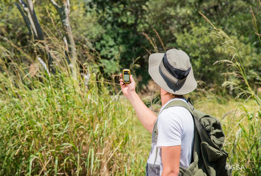
GPS is now a part of everyday life, the ability to know exactly where you are on the planet was the dream of every navigator for millennia, now this is available at the press of a button. GPS is widely used in a variety of technologies such as mobile phones apps, cars navigation for both mapping and incident reporting, wildlife tracking which has yielded some interesting results for migratory birds and mammals and preventing crime by tracking desirable objects. This tech has only been available to the public since the year 2000 and has since become the most popular method of accurately establishing a location within metres.
Introduction
A short history of GPS Systems
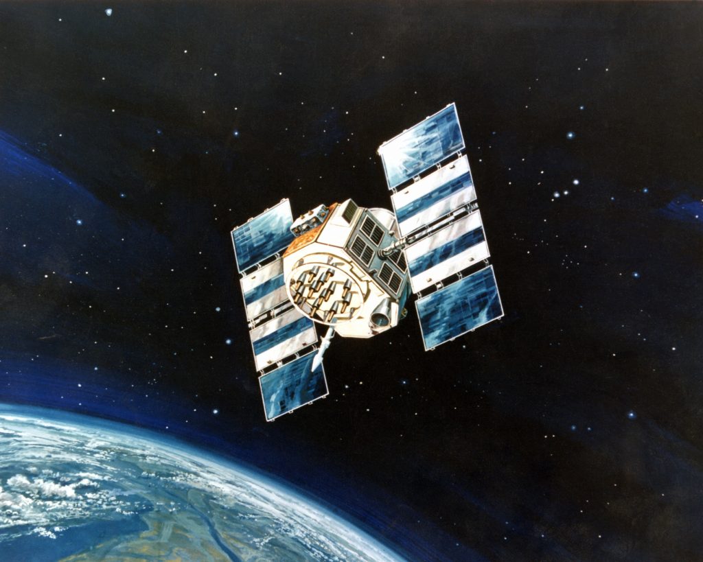
The first publicly available Global Navigation Satellite Systems (GNSS) was the USA’s Navstar GPS satellite constellation. This was a satellite-based radio navigation system owned by the United States government established in 1978 for the USA military and made public in the year 2000 by the Clinton administration. America’s newest GPS system is now just one of many that provide geolocation and time information to a GPS receiver anywhere on Earth where there is an unobstructed line of sight to four or more GPS satellites. Other GPS systems include Russia’s GLONASS, the European Union’s Galileo, and China’s Beidou Navigation Satellite System which offer varying degrees of accuracy, the Galileo system being the most accurate at less than 1 metre for public use and up to 20 cm accuracy for paying customers in 2021.
Artist’s concept of a NAVSTAR Global Positioning System satellite, a space-based radio navigation network.
How does a GPS work?
GPS systems use sets of dedicated satellites, called constellations, these are not stationary but are circling the earth so ‘rise and set’ twice a day, the satellites constantly send out signals, the GPS receiver listens for these signals they don’t transmit anything back to satellites. To determine the location of the GPS satellites two types of data are required by the GPS receiver: the almanac and the ephemeris. The almanac contains information about the status of the satellites and approximate orbital information allowing the receiver to see which satellites should be visible. After establishing what satellites should be available for you to get a fix, your GPS receiver requires additional data transmitted by each satellite, called the ephemeris, this data gives very precise information about the orbit and location of each individual satellite. The GPS receiver uses the ephemeris data to calculate the location of a satellite within a couple of metres and then by using the information that was transmitted to the GPS, your position can be calculated by triangulation using the delta in time signal transmitted and when it was received plus the location of the satellites. The ephemeris is updated every 2 hours and is usually valid for 4 hours, so If your GPS receiver has been off for a while, it may take up to several minutes to receive the ephemeris data from each satellite, before it can get a fix, this is known as a cold start. Obstacles such as mountains and buildings block the relatively weak GPS signals, this will ‘lengthen’ and therefore distort the time to receive the data or even give a false location. On a Mobile phone, there is an additional A-GPS mode which uses the cell towers to calculate the initial position of the user very quickly but with less accuracy, unlike pure GPS this may send information back to a server where that might be helpful to process position. Once the receiver calculates its distance from four or more GPS satellites, it can figure out where you are to approximately a 7.8-metre accuracy and depending on the system in use the accuracy might increase. Using GPS for locating a point of the earth is a key component for Geocachers in their quest to find caches, hence the saying follow the arrow.
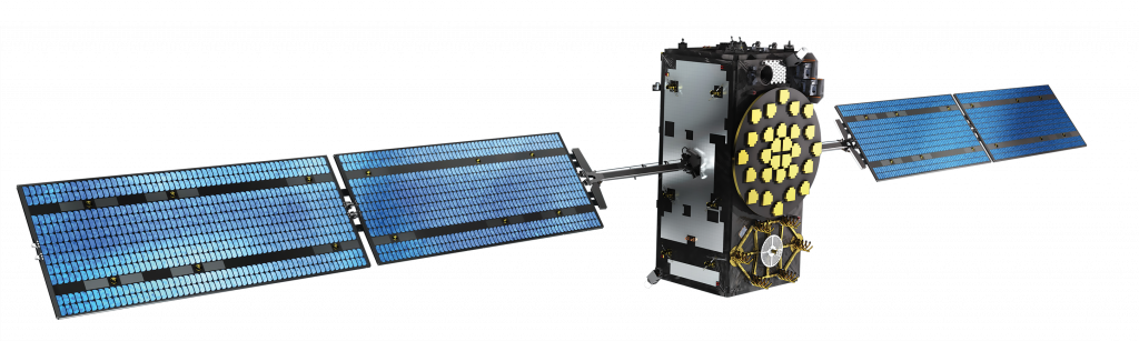
One of the Galileo Satellite Constellation
Tips and tricks 1 Having obstructions between the GPS and satellites causes issues where 3 – 4 satellites cannot be seen simultaneously, this is most often seen in cities and forests where accuracy quickly degrades.
2 Multi-path or Signal reflection occurs when the GPS signal is reflected off buildings or other objects, this can delay the time-clock signal sent out by satellite and cause a miscalculation again resulting in degradation of accuracy.
3 In the Northern Hemisphere Face the internal Antenna toward open Southern, SW, SE, in the Southern Hemisphere revers this, most of the satellites are clustered around the equator, this will make getting a fix and maintaining on easier.
4 Low batteries invariably cause issues with GPS systems, make sure that your batteries aren’t on their last legs.
5 When you switch on GPS after moving more than 25 miles or replacing batteries keep it in one position in the open air to allow the ephemeris data to update, it will get a fix far quicker than moving with it.
6 Keep firmware up to date, if there are any bugs in your GPS program an update will fix the issues. If there are more up-to-date base maps in GPS standalone system, an update will repair that, too.
7 GPS systems are not infallible so use common sense and your Mk 1 eyeball to check what you are being told by the system matches reality, learn to read a map and research where you are going. Most Geocachers will have stories of reaching a river or cliff face and being just meters from a cache that could not be reached without retracing their steps and trying another path.
Some areas have it all, great countryside and some of the best geocaches. If you have a favourite location and would like it to be included here, please contact us.
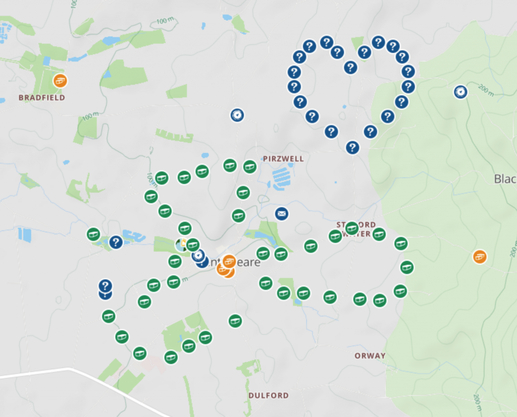
The Moseley’s Recommend Kentisbeare
If you are ever in Devon, you must visit a little village called Kentisbeare! This area is filled with fantastic geocaches placed by a geocacher called heartradio.
We travelled to Devon for the Mega in 2017, but decided against camping on site because we dragged along a then 6 month old Moseley_Bach with us, so we stayed in a static caravan near Kentisbeare, and accidentally stumbled across these caches nearby.
In this village and the surrounding area you can find traditional caches, multi caches, a devious mystery cache geo-[he]art, earth caches, letterbox caches and wherigos! And within these caches, there are Church Micros, Village Halls, Little Bridges, Village sign and a Fine Pair!
We spent days exploring the numerous paths and finding the varied containers and some near impossible caches.
We had to message heartradio a few times for some help, and he always obliged. He passed us one day as we searched for a particular difficult cache and stopped to say hello!
We didn’t manage to complete his caches, and will hopefully return to the area one day to find more!
We have 31 new caches published this week, all premium members only, that should keep everyone busy over the weekend. We have also included a couple of updates from this summers mega events.
GC98TR7 # 1 Hike or Bike by Fudgeman D1/T1 Traditional GC98TT1 #2 Hike or Bike by Fudgeman D1/T1 Traditional GC98TTR #3 Hike or Bike by Fudgeman D1/T1.5 Traditional GC98TV9 #4 Hike or Bike by Fudgeman D1/T1.5 Traditional GC98TVV #5 Hike or Bike by Fudgeman D1.5/T1.5 Traditional GC98TWC #6 Hike or Bike by Fudgeman D1/T1.5 Traditional GC98TWV #7 Hike or Bike HALO by Fudgeman D1.5/T1.5 Traditional GC98TXF #8 Hike or Bike by Fudgeman D1.5/T1.5 Traditional GC98TY0 #9 Hike or Bike by Fudgeman D1.5/T1.5 Traditional GC98TYE #10 Hike or Bike by Fudgeman D1.5/T1.5 Traditional GC98TYN #11 Hike or Bike by Fudgeman D1.5/T1.5 Traditional GC98TZ5 #12 Hike or Bike by Fudgeman D1.5/T1.5 Traditional GC98TZR #13 Hike or Bike HALO by Fudgeman D2.5/T1.5 Traditional GC98V08 #14 Hike or Bike by Fudgeman D1.5/T1.5 Traditional GC98V1T #15 Hike or Bike (Bodowyr Burial Chamber) by Fudgeman D1/T1.5 Traditional GC98V1Y #16 Hike or Bike by Fudgeman D1.5/T1.5 Traditional GC98V2J #17 Hike or Bike HALO by Fudgeman D2.5/T1.5 Traditional GC98V2Z #18 Hike or Bike by Fudgeman D1.5/T1.5 Traditional GC98V37 #19 Hike or Bike by Fudgeman D1.5/T1.5 Traditional GC98V3G #20 Hike or Bike by Fudgeman D1.5/T1.5 Traditional GC98V3P #21 Hike or Bike by Fudgeman D1.5/T1.5 Traditional GC98V44 #22 Hike or Bike by Fudgeman D1.5/T1.5 Traditional GC98V4B #23 Hike or Bike by Fudgeman D1.5/T1.5 Traditional GC98V4K #24 Hike or Bike by Fudgeman D1.5/T1.5 Traditional GC98V54 #25 Hike or Bike by Fudgeman D1.5/T1.5 Traditional GC98V5A #26 Hike or Bike by Fudgeman D1.5/T1.5 Traditional GC98V5M #27 Hike or Bike by Fudgeman D1.5/T1.5 Traditional GC98V62 #28 Hike or Bike by Fudgeman D1.5/T1.5 Traditional GC98V69 #29 Hike or Bike by Fudgeman D1.5/T1.5 Traditional GC98V6H #30 Hike or Bike by Fudgeman D1.5/T1.5 Traditional GC98V6W #31 Hike or Bike by Fudgeman D1.5/T1 Traditional
Update from London Calling 2021 Mega
I am not sure if any one is planning on attending GC8JAYF London Calling 2021 but here is the latest announcement from the organisers:
“There’s just one month left to pre-order bus geocoins and supporters packs!
These are going to be removed from the online store at the end of May, in order to give us enough time to order in the coins and other items.
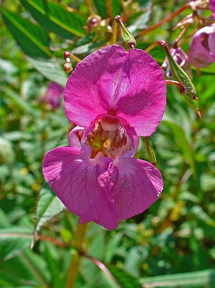
As the name suggests Himalayan Balsam comes originally from the Kashmir and Uttarakhand areas of the Himalayas. It was first introduced into Kew Gardens in 1839 as an annual greenhouse plant. Being easy to grow and having attractive pink/white trumpet shaped flowers it became a very popular plant with gardeners. Within 10 years it had escaped from the confines of gardens and begun to spread along the river systems of England.
Himalayan Balsam grows very quickly and once established in an area, forms dense thickets of up to 2 meters high. Each plant can produce up to 800 seeds, the seed pods once ripe, explode shooting the seeds up to 7m away from the parent plant. If the seeds land in a waterway they float down stream before settling in soft mud banks and germinating. The seeds can remain viable for up to 2 years.
Himalayan Balsam image Wikipedia
Why do we need to control Himalayan Balsam?
It smothers native vegetation by crowding and shading out light, in the winter it dies back leaving bare earth which is then subject to erosion. This can cause major problems along river banks. The dead plant debris can block waterways causing flooding and more damage to local habitats. Being very rich in nectar its flowers attract a wide array of pollinating insects. Studies are taking place on how this effects the pollination of our native plants. Initial finding suggest that it does have a detrimental effect as reduced numbers of insects are visiting other flowering plants.
Himalayan Balsam seedling crowding out our native plants
Controlling Himalayan Balsam
Being a non-native plant it has no natural enemies to keep it under control. There are two traditional ways of removing Himalayan Balsam from a site hand pulling or spraying of chemicals. The best time of year for tackling the plant is May-July, before the seeds have set. Not all sites are suitable for either of these methods and trials of introducing a rust fungus from India are currently taking place in England and Wales.
Pete and I are probably the only people in the world that are pleased to see this event has been pushed back to May 2022 as this means we will be able to attend after all. We hope to put into place our original plans and are hoping others can join us.
“GC7WWWW 20 Years of Geocaching Prague 2020 – Edition 2022 Although we were hoping for better news, the situation is unfortunately not such that it will be possible to carry out a gigaevent in 4 months. This event will not take place in September 2021 because of health and safety concerns related to COVID-19. It will be rescheduled to 13-15 May 2022. Hopefully, the situation will be stabilized next year. We believe that it will be possible to organize a grand celebration in a joyful and relaxed spirit, so that both participants and organizers can enjoy it. Once it is rescheduled, we will post an Announcement and update this page.”
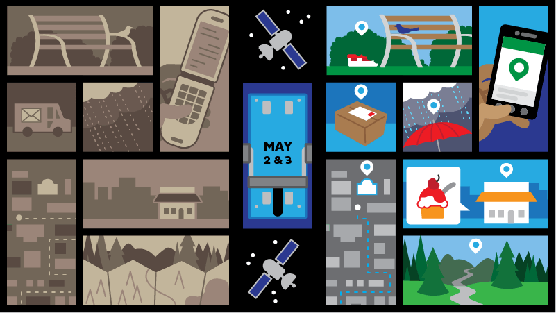
Global Positioning System (GPS) when first developed was only available to the US military. Later civilians were allowed access with Selective Availability (SA) but the GPS signal accuracy was greatly reduced.
May 2nd 2000, on the instructions of President Bill Clinton, the US government turned off its Selective Availability. By “flipping the switch” everyone had access to high accuracy GPS signal. Twenty-four satellites around the globe processed their new orders, and instantly the accuracy of GPS technology improved tenfold. Tens of thousands of GPS receivers around the world had an instant upgrade. Even though there was not a blue switch, for some unknown reason, geocachers refer to this day as Blue Switch Day.
With the availability of accurate GPS signal the world changed forever with the introduction of new technologies that today we take for granted. Gone are the days of the road atlas!
May 3rd 2000 saw the first geocache hidden by Dave Ulmer in Oregon and the beginning of the game that we know today.
2017 Souvenir
In celebration of this Blue Switch Day geocaching first introduced a souvenir in 2017. To obtain your Blue Switch Day 2021 souvenir simply find either a geocache, an Adventure Lab or attend an event anytime between May 2nd to December 31st.
If you found yourself dropped into a random location on Earth, would you be able to use clues about the vehicles, vegetation, landscape, buildings, and signs to figure out where in the world you have been placed?
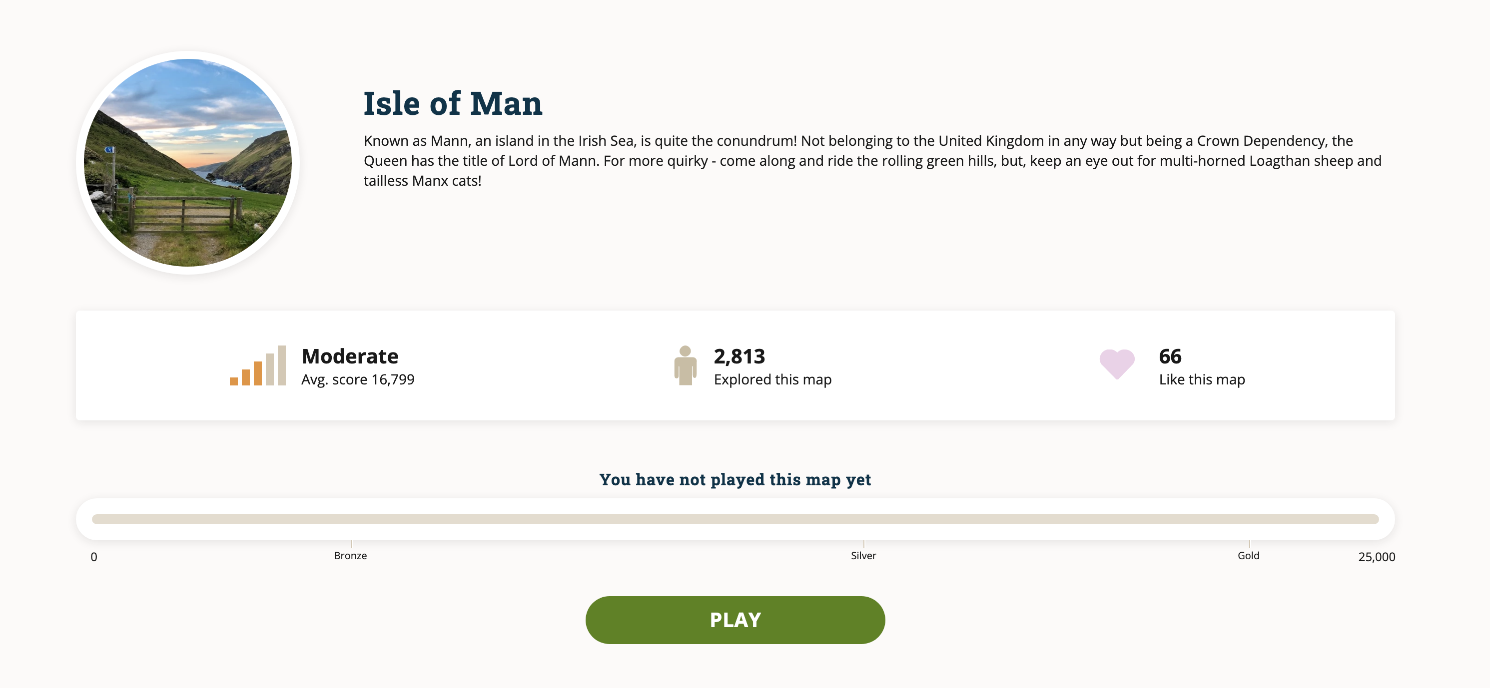
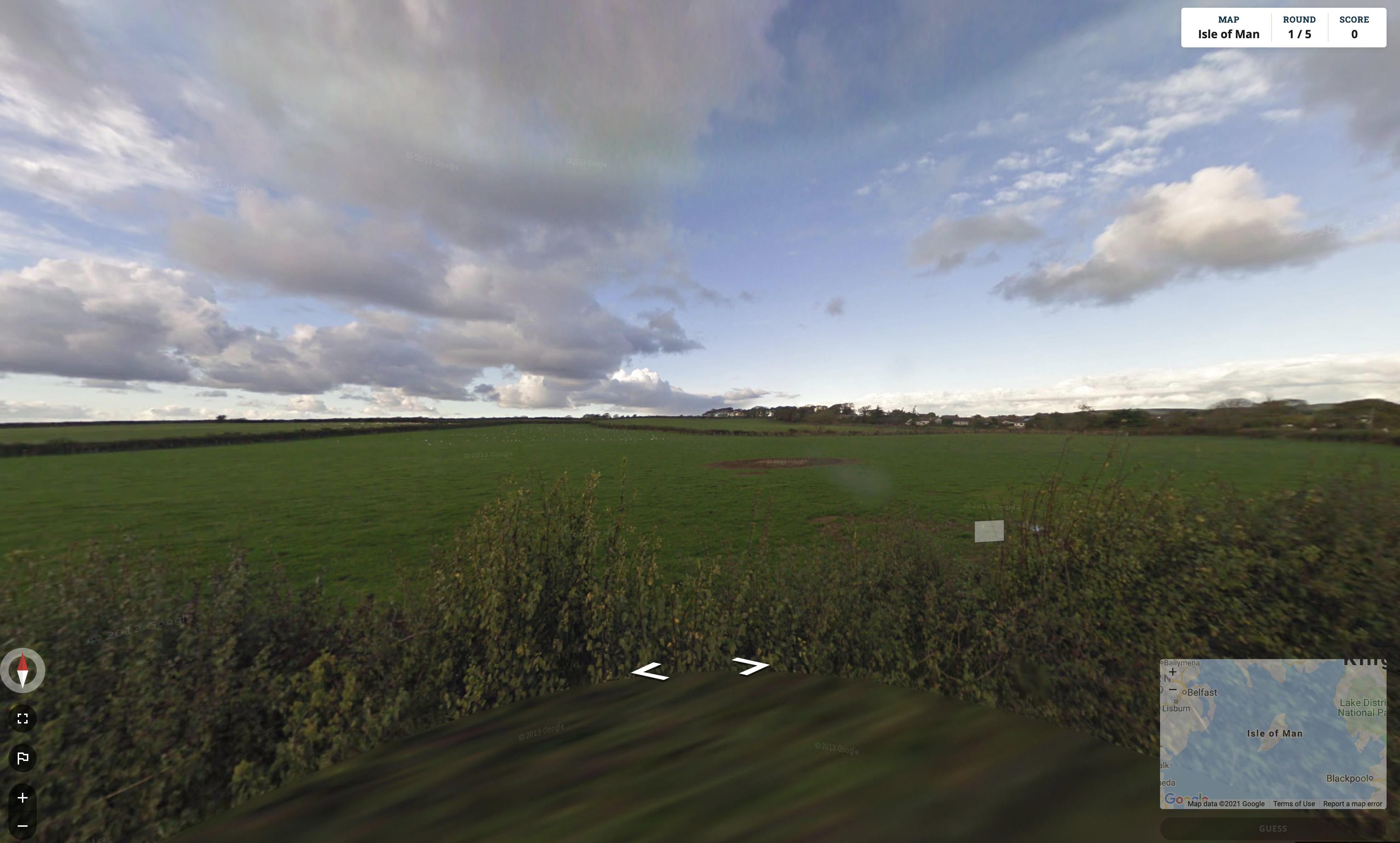
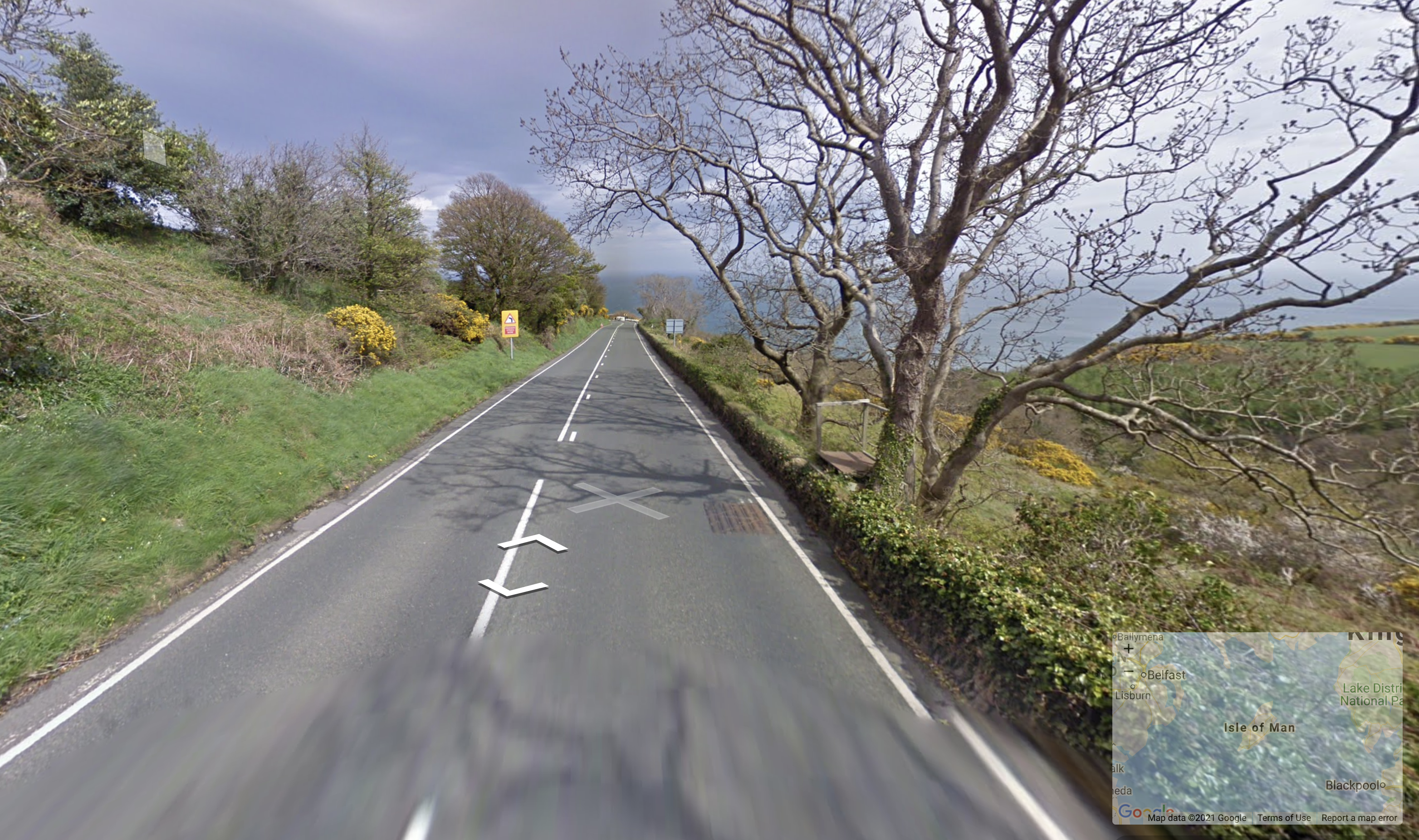
GeoGuessr is an online game that uses Google Street View to provide 5 locations for you to work out where you are, sometimes it’s easy, say being dropped in the centre of a large city with plenty of recognisable landmarks and street names, however being dropped on the Mongolian Altai alpine meadow with no recognisable structures is way more challenging (hint, yurts a good sign that you are in Mongolia). Like Geocaching this game increases your awareness of the ordinary world as you become more conscious of different writing systems on signs around the world, or styles of building, vehicles, dress even road markings sometimes provide a clue and to where you are.
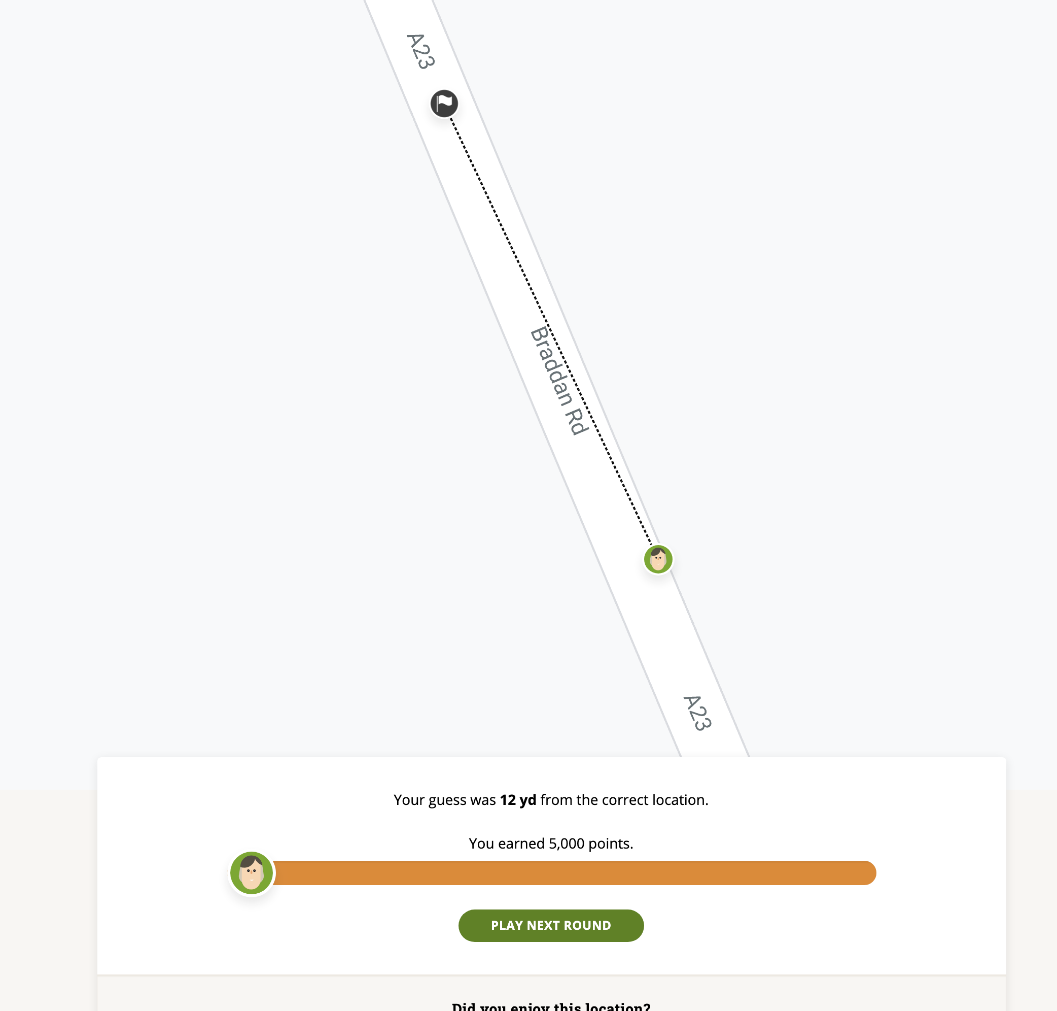
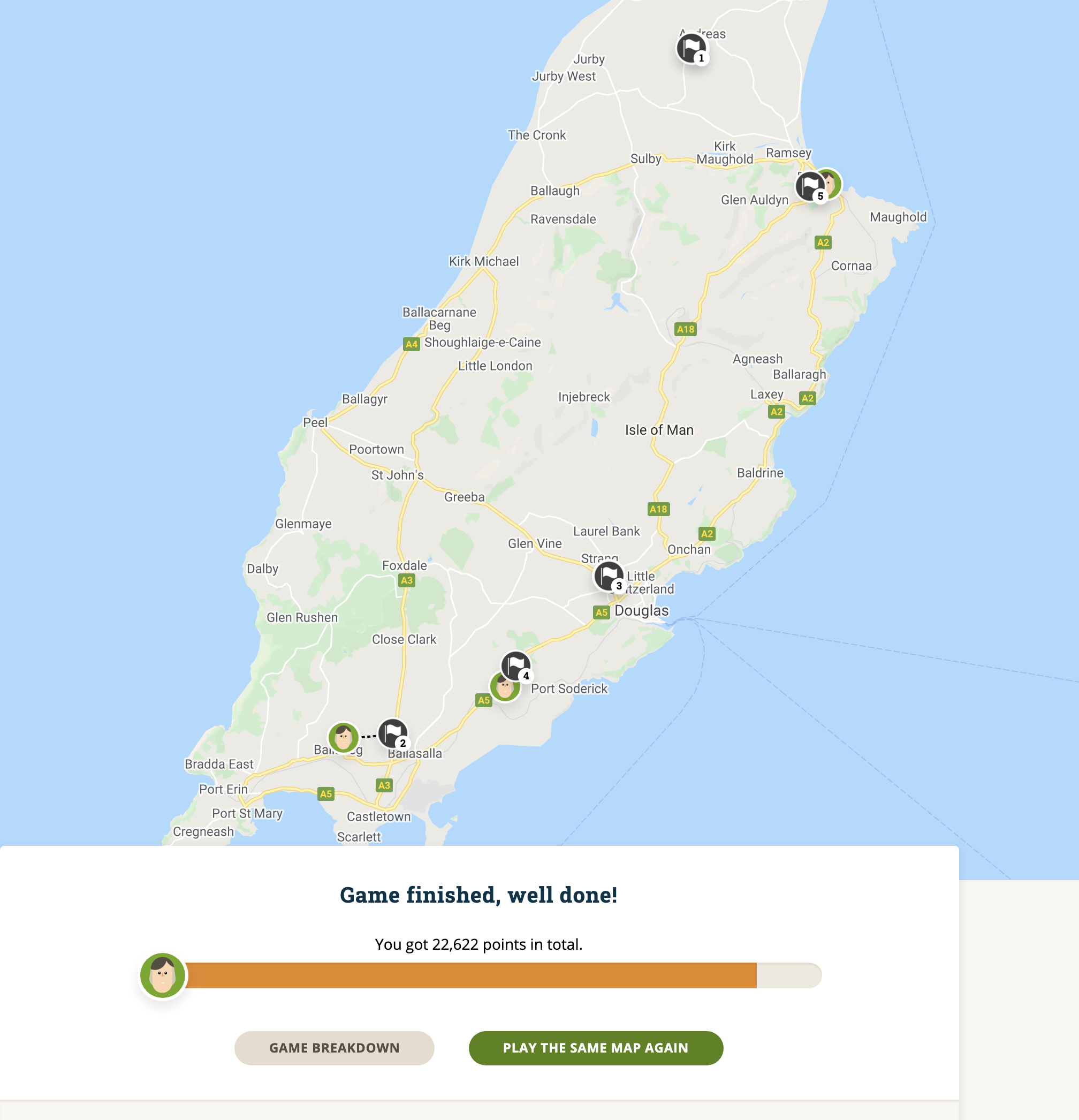
The scoring is different by game but consistently a “perfect” guess is worth 5000 points with descending scores depending on the size of the map and eventually decreasing to 0 for being at the point on Earth’s surface diametrically opposite to the target (antipode). A typical game lasts five rounds, so 25,000 points would constitute a perfect game score.
Start the game
Start Game
Drop off Point
More Information
My Guess
There are various Modes available,
Daily Challenge – only one go at this allowed per day with 5 rounds, each with a 3-minute limit to get as close to the Landing point as possible. There aren’t any formal rules for the Daily Challenge or GeoGuessr, like Geocaching you set your own rules, to us Googling somehow seems to be cheating and we avoid that.
Explorer mode – Pick a country to play from the map or the list and explore. This is single player mode with unlimited time to explore, medals are awarded for high scores, with the goal of a gold medal for each country available.
Country Streak– this can be played either as a single-player or challenge mode where players can compete against each other. The simple objective in this mode is to guess the country you are in rather than guessing the specific location. There are several options for this where you can restrict movement, panning and/or zooming and if that isn’t enough pressure a time limit can be set as well. Players are challenged to attempt at scoring as many correct guesses as possible in one attempt, the game finishes when the player guesses a country wrong.
Battle Royale – compete with others, where one by one player are eliminated until only the winner remains.
There are many other options such as ‘famous places’, ‘urban worlds’ and even a ‘dumb test’ with ultra-easy maps to explore.
Free vs Paid In 2019 Google increased its prices for using Street View and Google Maps forcing GeoGuessr to limit the free play game. Charges are kept at a minimum with the present cost of pro membership being $1.99 per month or $23.88 per year. Pro members get unlimited maps access to Daily challenge, Pro Leagues where you can set up your own league with your friends. Games are scheduled automatically, and notices sent to your fellow explorers. Also making and sharing your own maps is available at this level.
This is an addictive game in both the limited free and pro versions, it’s a substitute for actually being there and exploring and well worth the subscription fees as a replacement for Geocaching whilst we are ‘locked down’
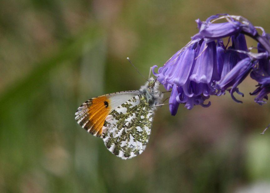
Sunday 18th April 2021 This week saw our first sighting of an Orange Tip butterfly fluttering along the side of the river. They are one of my favourite butterflies as it indicates the warmer, longer days are here and summer is not far off. Our damp boggy fields are an ideal habitat and support a large colony.
They fly from late March to June depending on weather conditions. This butterfly lives in damp meadows, ditches, woodlands and hedgerows as this is where the caterpillars food plants grow, cuckoo-flower, garlic mustard and many other plants in the mustard family.
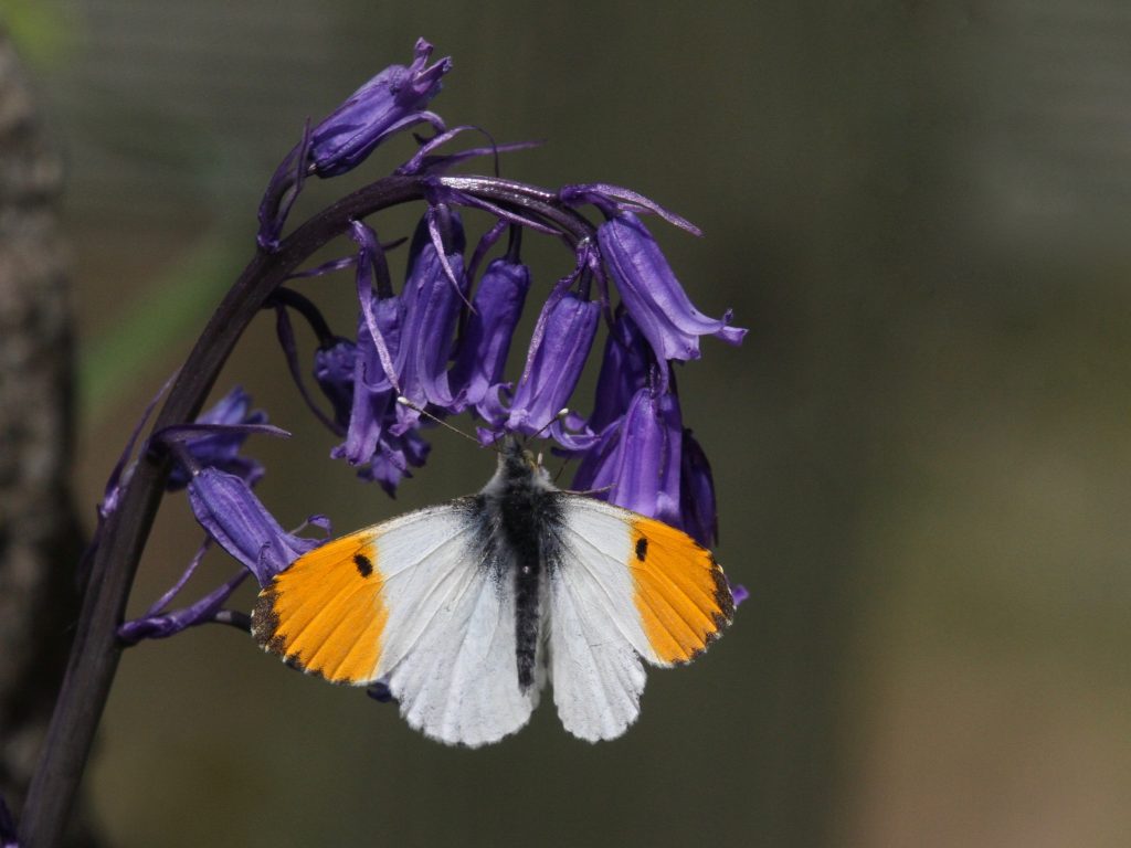
Male
Orange Tips are a very common butterfly, the male has the distinctive orange tipped wings which the females lack so they are not so easily recognised and can be mistaken for Small Whites.
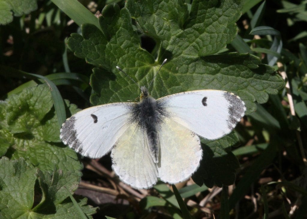
Female
The under wings of both sexes have dappled dark green patterns with black scaling this gives excellent camouflage when the butterfly is at rest.
Under Wings
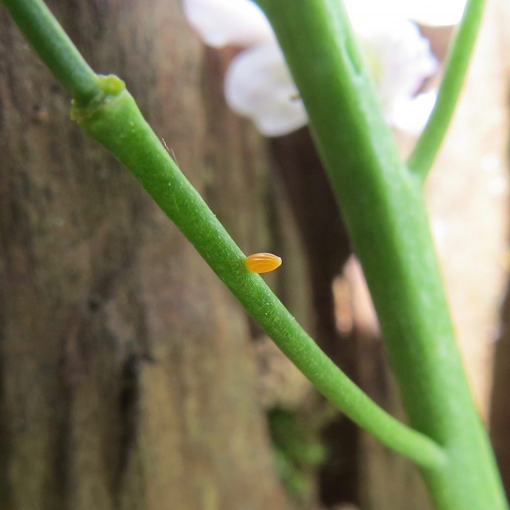
The females lay single barrel-shaped, grooved eggs on the underside of leaves and flowers of the food plant.
Newly laid egg
The eggs take around 14 days to hatch and change from yellow/white when first laid to orange and then grey just before they hatch. The caterpillars are blue-green with small black dots and broad white stripe. It takes about 5 weeks for them to become fully grown when they change into a narrow, curved, green or brownish chrysalis attached by a girdle to a plant stem. Here it hibernates over winter emerging as an adult the following spring.