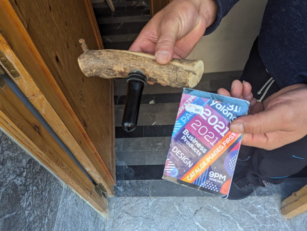
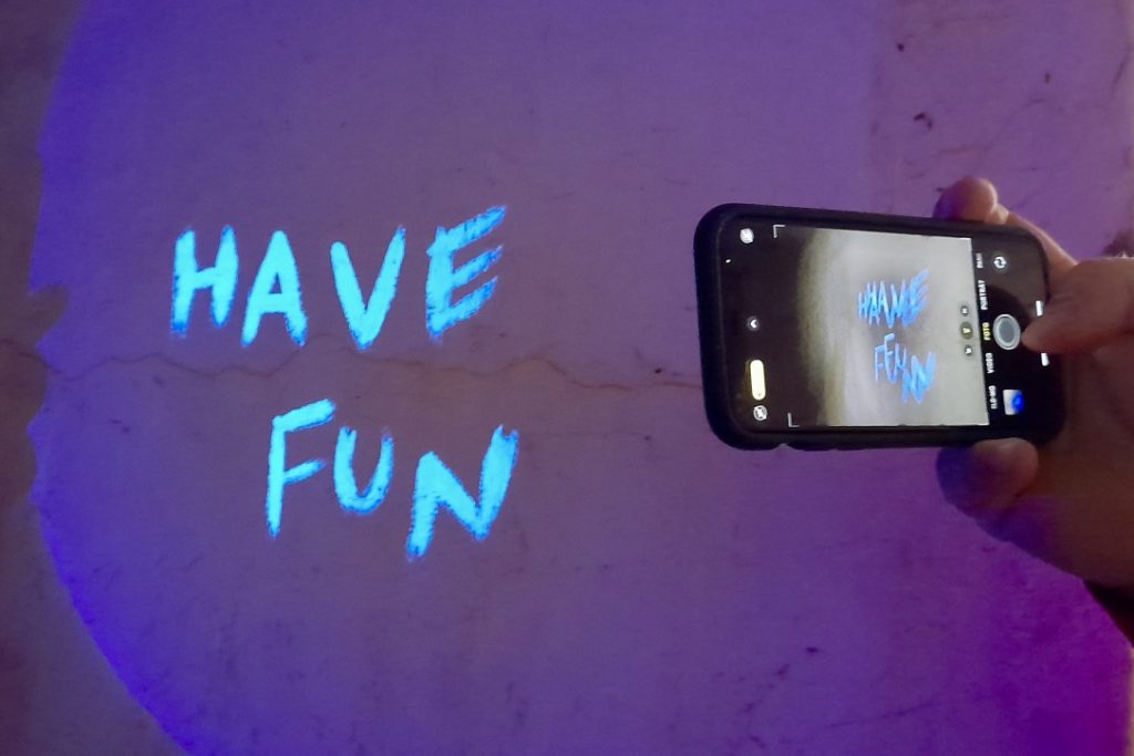
GCAAR25 Piratemania Germany by Piraten Crew Block Party D1/T1
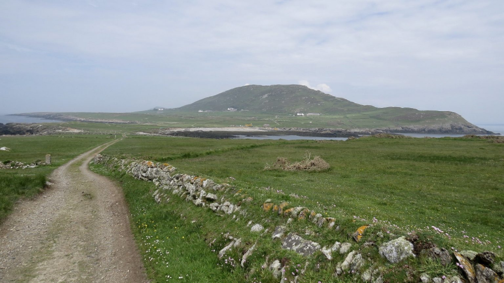
On July 5, 2025, the ever popular UK geocaching event Piratemania has spread across the North Sea and had a very German take at the Panarbora Nature Discovery Park in Waldbröl, North Rhine-Westphalia. Held as a Geocaching HQ Block Party and coinciding with geocaching’s 25th anniversary, the event drew adventurers from across Europe for a day of pirate-themed exploration and family fun.
The scenic Panarbora Park— with its breathtaking treetop walkway, 40m high observation tower, and nature trails—served as the perfect family friendly backdrop, there were geocaching & AdLab routes, shopping, story telling, treasure hunts, and an evening’s entertainment for those staying on site.
Panabora TowerPart of the tree walk from baseView from the tree walk
Accommodation consisted of either cosy treehouses or motorhome spots which were adjacent to the Event, admission to the event was €10 (this is perfectly normal for events on mainland Europe), though overnight guests entrance fee was covered in the treehouse agreement.
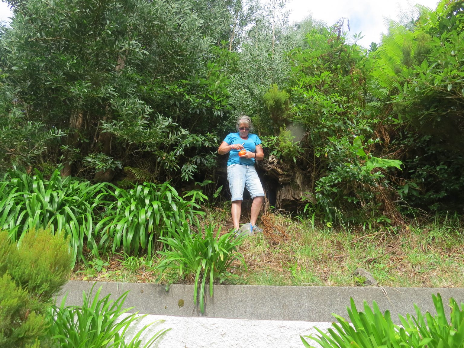
Ann@Birdbrook by Pirate ShipThe rest of the crew
Ann@Birdbrook and Naturesbyte, opted for the ‘International’ motorhome site. As the only Brits among the overnight campers, they were warmly welcomed by their European neighbours, highlighting the inclusive and friendly spirit that defines the geocaching community.
Blending adventure, community, and outdoor fun, this German edition of Piratemania truly embodied the spirit of geocaching—bringing people together to explore, connect, and create unforgettable memories in the great outdoors.
International crew
Many thanks to the The “Piraten Crew” who so worked hard in making this event happen.
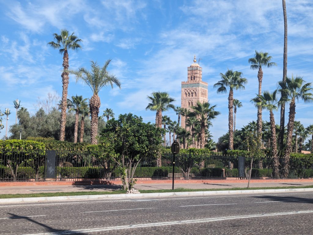
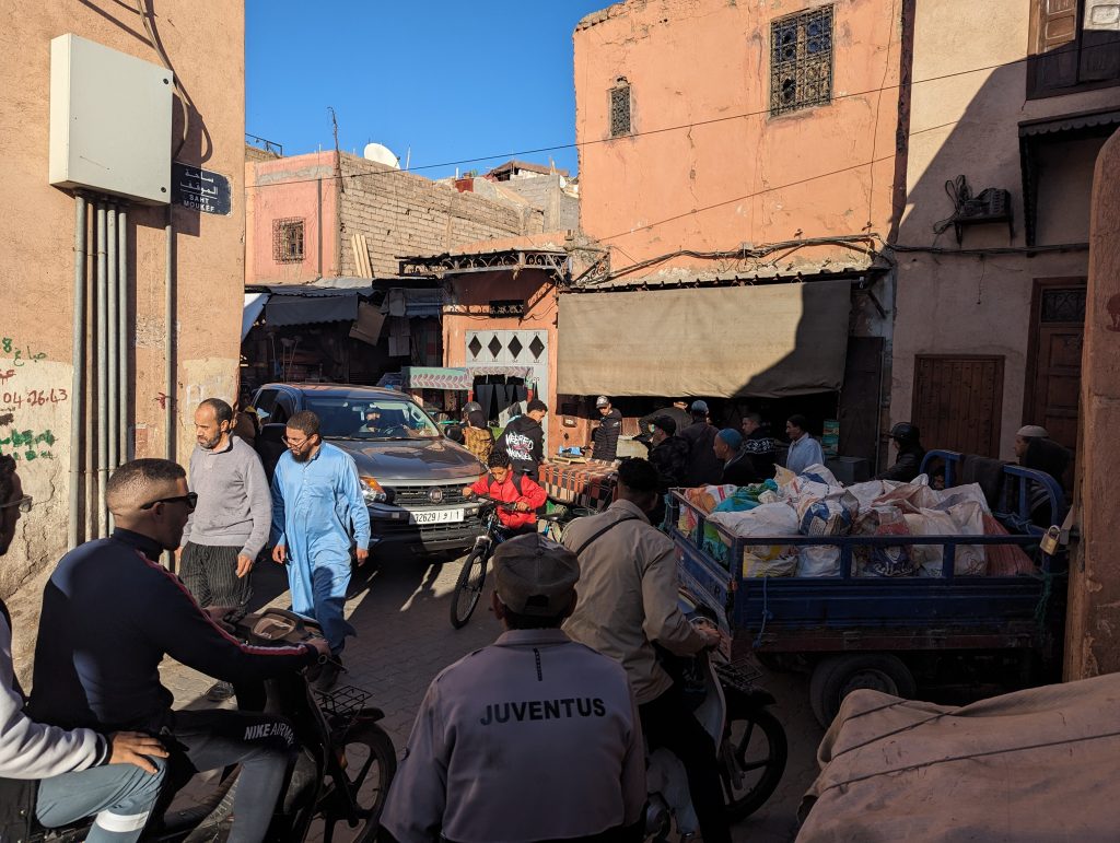
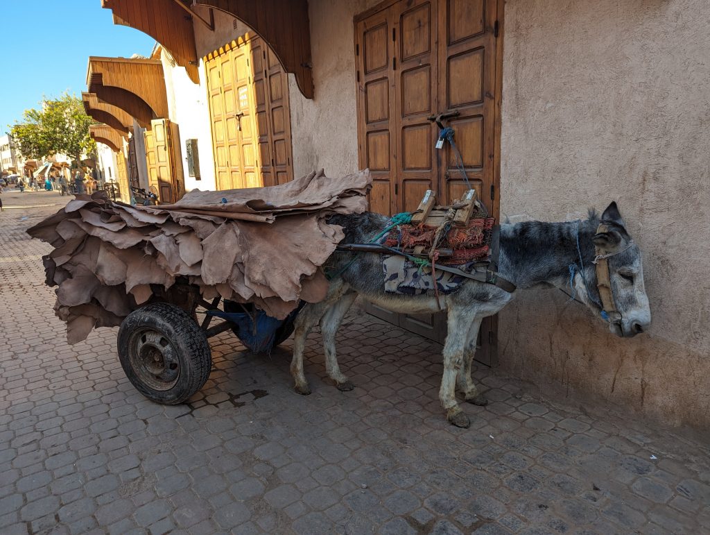
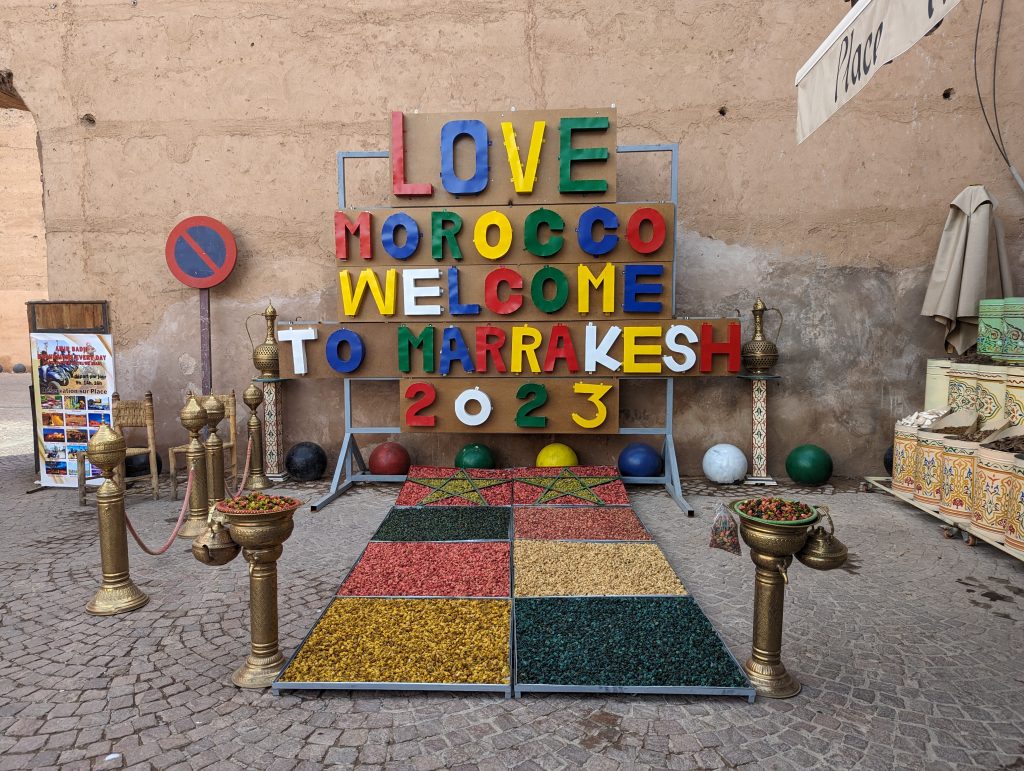
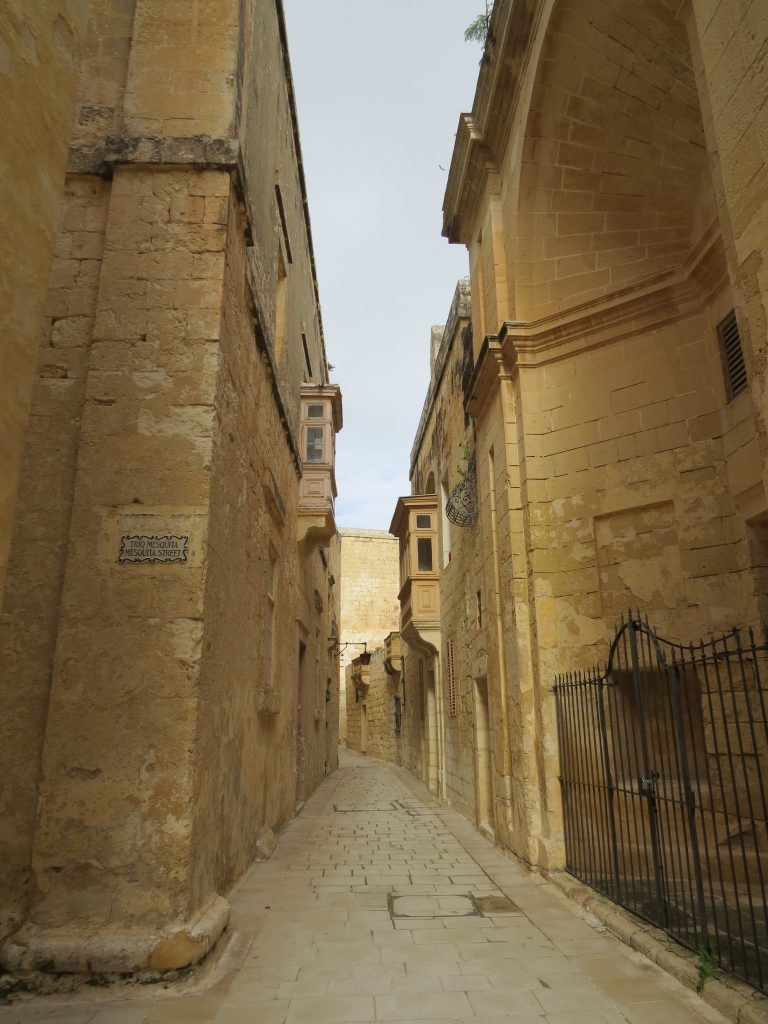
Marrakesh is the fourth largest city in Morocco, a former imperial city with beautiful mosques, palaces and gardens. The city is divided into two, the ancient and new. The walled medieval Medina dates back to 1070 and the Berber Empire, it is densely packed with a maze of alleys full of souks (market stalls) selling everything from traditional textiles, pottery, leather items, household goods, spices, fruit, vegetables, meat to street food. Step outside the old city walls to find a very modern world of wide streets lined with trees, gardens, expensive apartments, hotels and shopping centres full of designer goods from around the world.
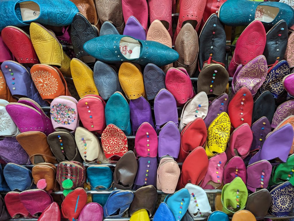
Colourful babouche slippers
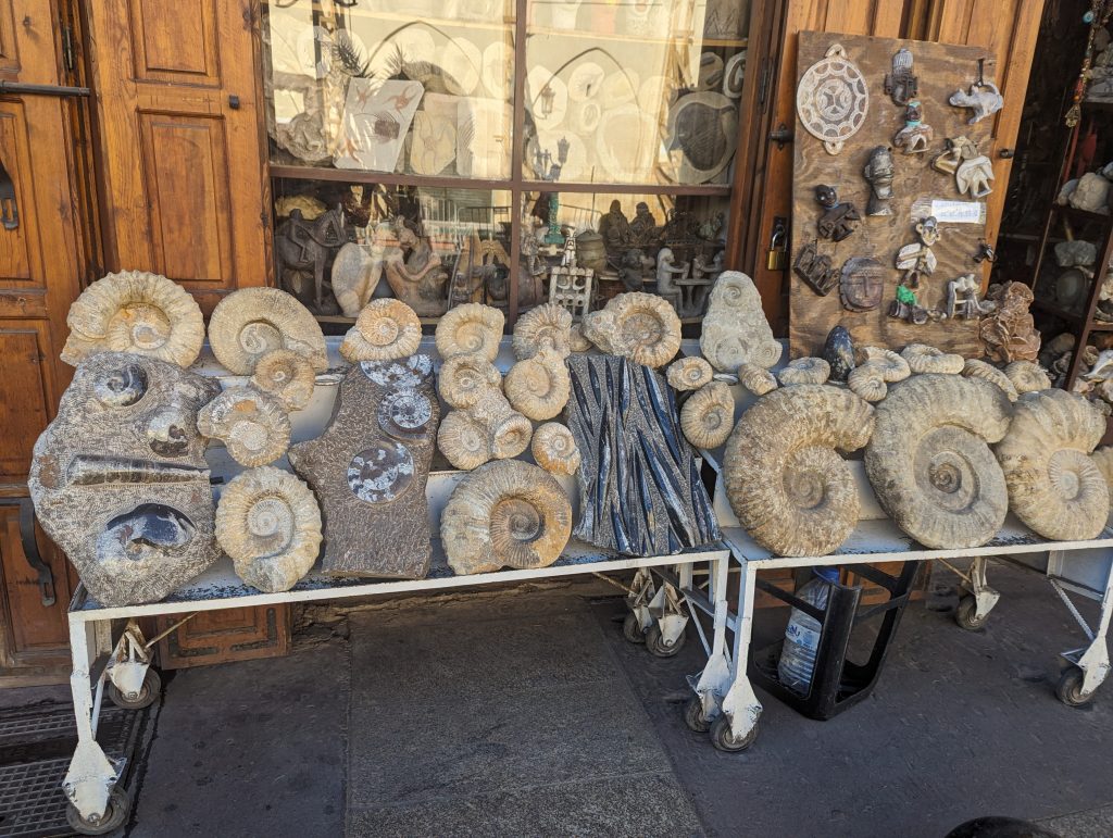
Souk selling amazing fossils
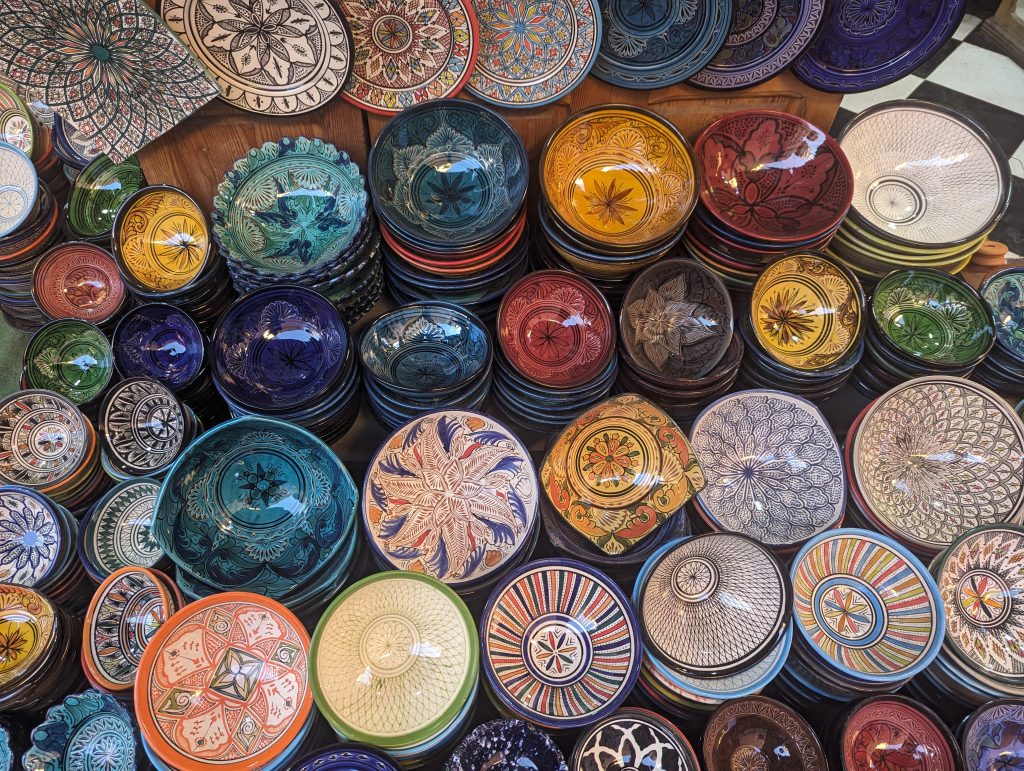
Beautifully decorated bowls
For the geocacher there is, at the time of writing, 15 caches, 12 traditionals, 2 earthcaches and a mystery plus 3 sets of Adventure Labs which will take you to the highlights of the city. Forget the rules of UK geocaching, here caches are placed in souks, cafes and restaurants with the sole intention to promote the business. Staff and local tradesmen are all aware of the geocaches, they will point you in the right direction of the cache while trying to sell you their wares.
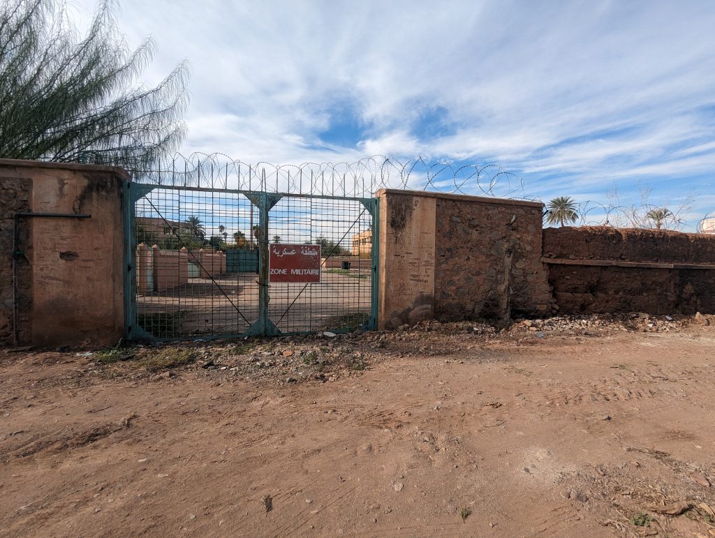
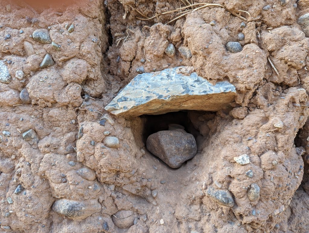
Here in North Wales caches are never allowed to be placed in stone walls but in Marrakesh caches are hidden in holes carved out of the ‘fragile’ sun dried earthen walls. We also have rules on the proximity to airports or military establishments. The cache below is hidden in a wall surrounding the military area of the International airport.
GC1DB1F Marracache by the Mailers Traditional D1/T1.5
Military area of the Airport
Cache hidden in mud wall
We can highly recommend a visit, Africa meets Europe here, the city is crowded, noisy and chaotic, especially the Medina with its continuous streams of mopeds, bikes, cars and people. The weather can be very hot in the summer months but for us in December it was a very pleasant 18-27 degrees. We were surprised at how many people could speak English, we found the people friendly and very helpful.
General Information and things you should know before Visiting Morocco
British nationals don’t need a visa to enter Morocco as a tourist for stays up to 90 days. British nationals who stay longer than 90 days need to go to a local police station to request an extension. When entering the country, make sure your passport is stamped and you receive a tourist number. Some travellers have experienced difficulties leaving the country because their passport has no entry stamp.
In Morocco they drive on the right side of the road and seatbelts are mandatory, even though some taxis don’t have them. The city roads are crowded and chaotic. When walking always walk on the right side.
Chaotic alleys of the Medina in Marrakesh
Taxis are the easiest way to travel around the cities. Petite taxis take up to 3 passengers for journeys within city limits but be aware that the driver may pick up other passenger going in the same direction. Grand taxis are for longer journeys, take up to 6 passengers, it is a shared vehicle, you only pay for your seat. These taxis have a fixed route to a set destination.
The Moroccan dirham is a closed currency, which means you cannot use or get it outside the country. It is very much a cash economy, but cards are accepted in some of the larger establishments and tourist attractions.
A mixture of French, Arabic, Amazigh and English languages are spoken in Morocco.
Islam is the state religion, and the rules of Islam are applied to personal matters in the same way that state law works in other countries. It is illegal to speak disrespectfully about religion or the king. Non-Muslims are not permitted to enter mosques or cemeteries. Friday is a holy day across the country, and most people take a few hours off in the afternoon to go to the mosque and eat couscous with their families afterward.
It’s best to ask permission before taking someone’s photo, many people are fine with it, but others aren’t. Drones are not allowed in Morocco without special permission.
Alcohol is forbidden by Islamic law but is available in licensed wine shops and some international hotels and restaurants.
For electric plugs and sockets there are two associated plug types, types C and E. Plug type C is the plug which has two round pins and plug type E is the plug which has two round pins and a hole for the socket’s male earthing pin. Morocco operates on a 220V supply voltage and 50Hz.
There is free WiFi in some cafes and restaurants but we advise to buy a local pay-as-you-go sim card as roaming charges are very expensive. Mobile signal is very good.
Flights to Morocco from the UK are frequent, cheap and available from most large airports, flight times are about 4 hours.
A Bit About the Island It is suggested the island was inhabited from as early as the bronze age. It is known as the island of 20,000 saints, owing to the Celtic and Christian monasteries established there since the 6th century. The population of Ynys Enlli, which is 1.5 miles long and no more than half a mile across, has fluctuated over the centuries. Today the permanent winter population is two but In the summer they are joined by visitors who help work the land, record the bird and wildlife and manage the 9 self catering cottages. The island is off-grid with most of the buildings unchanged since they were built in the 19th century.
Bardsey Island is the first site in Europe to receive a dark sky sanctuary certification, thanks to low light pollution and pristine night skies.
Photo Andy YnysMonBirders on our 2016 trip
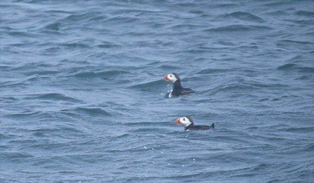
As well as puffins and seals there is plenty to explore and history to discover. Currently there are 2 sets of Adventure Labs and 2 traditional geocaches, we will also be holding an event on the island.
The Plan Proposed date is Sunday 28th May leaving Porth Meudwy at 11.30am. Cost £45.00 per adult and £25.00 per child There are only 12 adult places on this boat. We will be on the island for approximately 4 hours. You do not have to be a geocacher to join us.
If you would like to join us please contact us ASAP so that we can book, being a Bank Holiday weekend places are already limited.
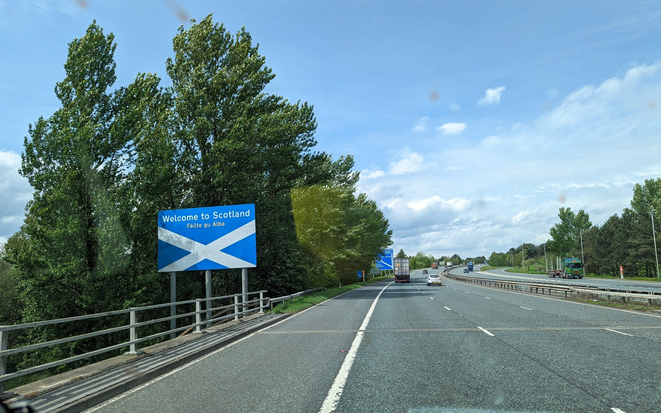
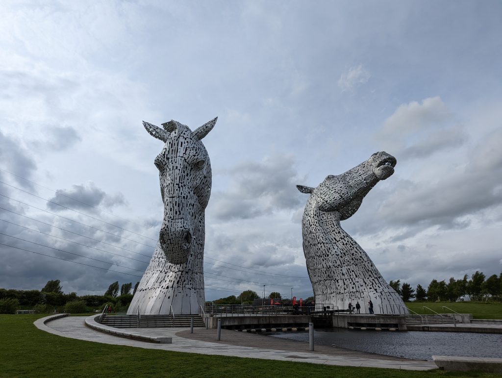
Here we are in dreich, wet, cold and windy, not quite what we had hoped for, but a welcome break none the less. We are currently stopped for the night in the Kelpies’ carpark for a very reasonable £7.50.
Kelpies sculptures by Andy Scott
The Kelpies are horse-head sculptures that depict shape-shifting water spirits. They are constructed out of stainless steel on a mild steel framework being 30 metres high and weigh 300 tonnes each. These are not only a superb piece of engineering and also are stunning to look at from every angle.
GC891CY Phooning with the Kelpies by Doodlejack virtual D1.5/T1.5
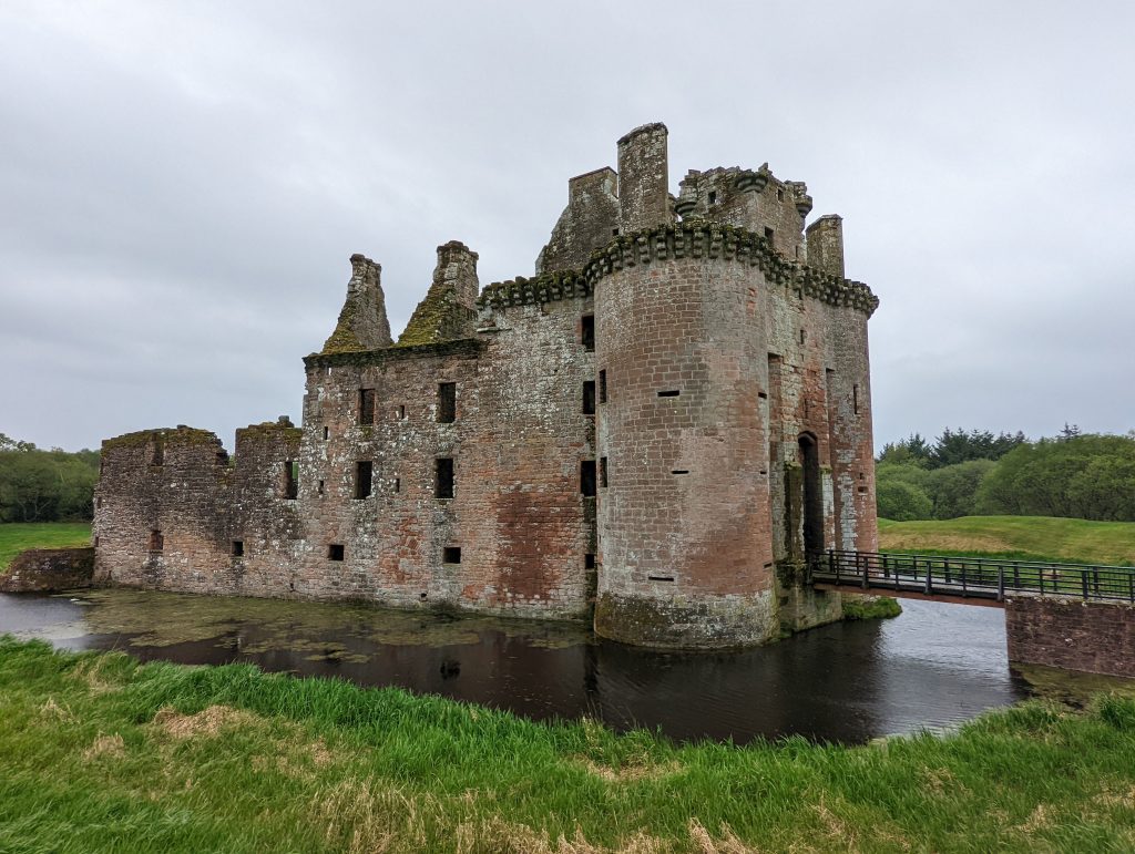
Caerlaverlock castle
In-between the weather we have managed to visit some amazing places and of course find geocaches and adventure labs.
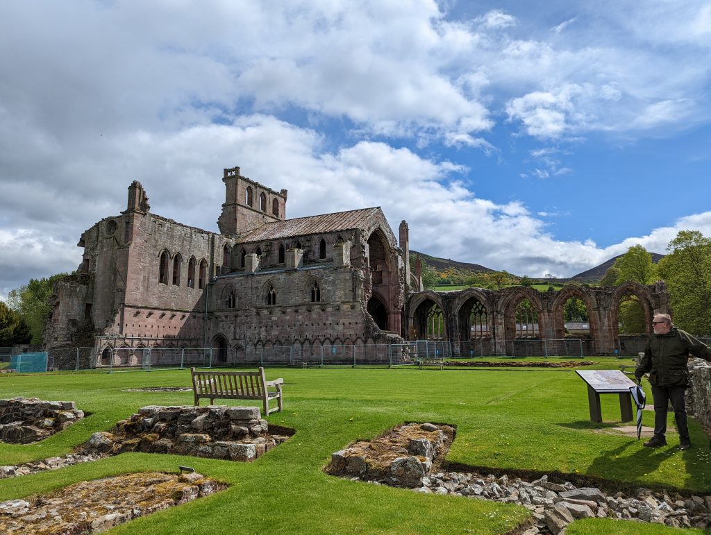
Melrose Abbey, note the umbrella at the ready.
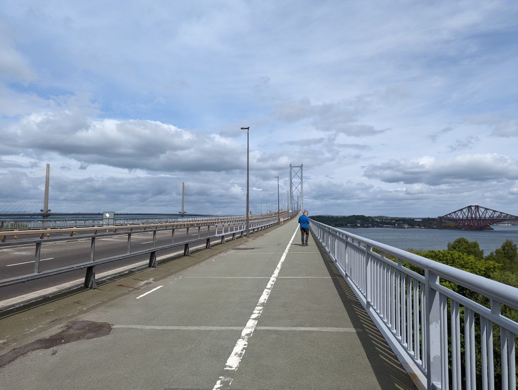
One of our ambitions was to walk across the Forth Bridge and to grab the virtual cache in the middle, we achieved this in the teeth of a freezing wind, but it was well worth it for the views. Since the opening of the “New” Forth Road Bridge only busses and taxis are the only motorised transport allowed across the bridge, there is a pedestrian and cycleway either side of the main carriageway at the moment only the east side is open. There was no sign of anyone painting the bridge, maybe they finally finished it!
GC7B69W Fiorth of Forth (Virtual Reward) by Devious_Dwarferkev virtual D2/T2
Old Forth Road Bridge
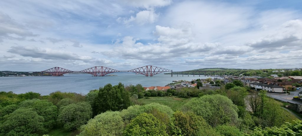
Forth Rail Bridge from start of the old Road Bridge
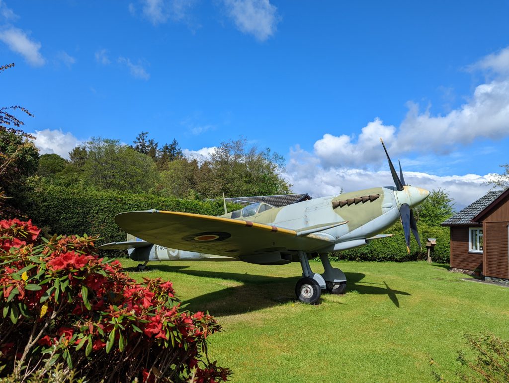
One of the adventure labs in Moffat took us down a leafy cul-de-sac to where a full size Second World War fighter plane was parked on a bungalow front lawn, it beats gnomes or solar water wheels for oneupmanship!
Full size Spitfire replica
As we compose this the rain is still pattering down on the roof of the van, hopefully tomorrow will bring sunshine for a trip to the Falkirk Wheel before heading off to Lindores Abbey Distillery.
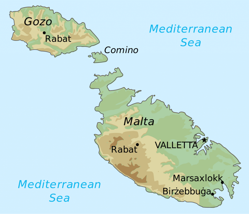
Looking for some winter sun? We can highly recommend Malta for a winter’s Geocaching break. The country of Malta consists of five limestone islands situated in the Mediterranean sea between Sicily and North Africa. Only the 3 largest islands are inhabited Malta, Gozo and Comino. Malta has a typical Mediterranean climate with mild winters and hot summers, rain occurs mainly in autumn and winter, with summer being generally dry. The average annual temperature is around 23 °C during the day and 15.5 °C at night. In August temperatures can exceed 35 °C. We visited at the beginning of February when daytime temperatures were 18-21 °C and we were very lucky to have no rain. The islands at this time of year are very pretty with masses of wild flowers, later in the year it can be very hot, dry, and dusty.
Independence from Britain was granted in 1964 and in 1974 Malta became a republic joining the EU in 2004. The islands have had a succession of different rulers including the Romans, Moors, Knights of Saint John, French and, lastly the British, all of which have left their influence in architecture and culture.
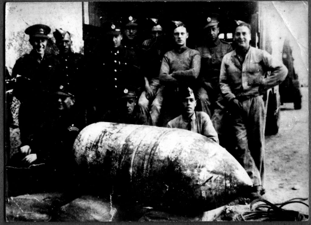
During the 2nd World War Malta was strategically a very important base for the Allied forces. The German and Italian air forces heavily bombed the islands causing devastating damage. In 1942 the George Cross was presented to the island of Malta in recognition of the bravery of the Maltese people. The beautiful catholic church at Mosta, Sanctuary Basilica of the assumption of our Lady, is famous for avoiding destruction when a German bomb fell through the roof of the dome during mass but failed to explode. This event was interpreted by the Maltese people as a miracle. A replica of the bomb can be found in the church.
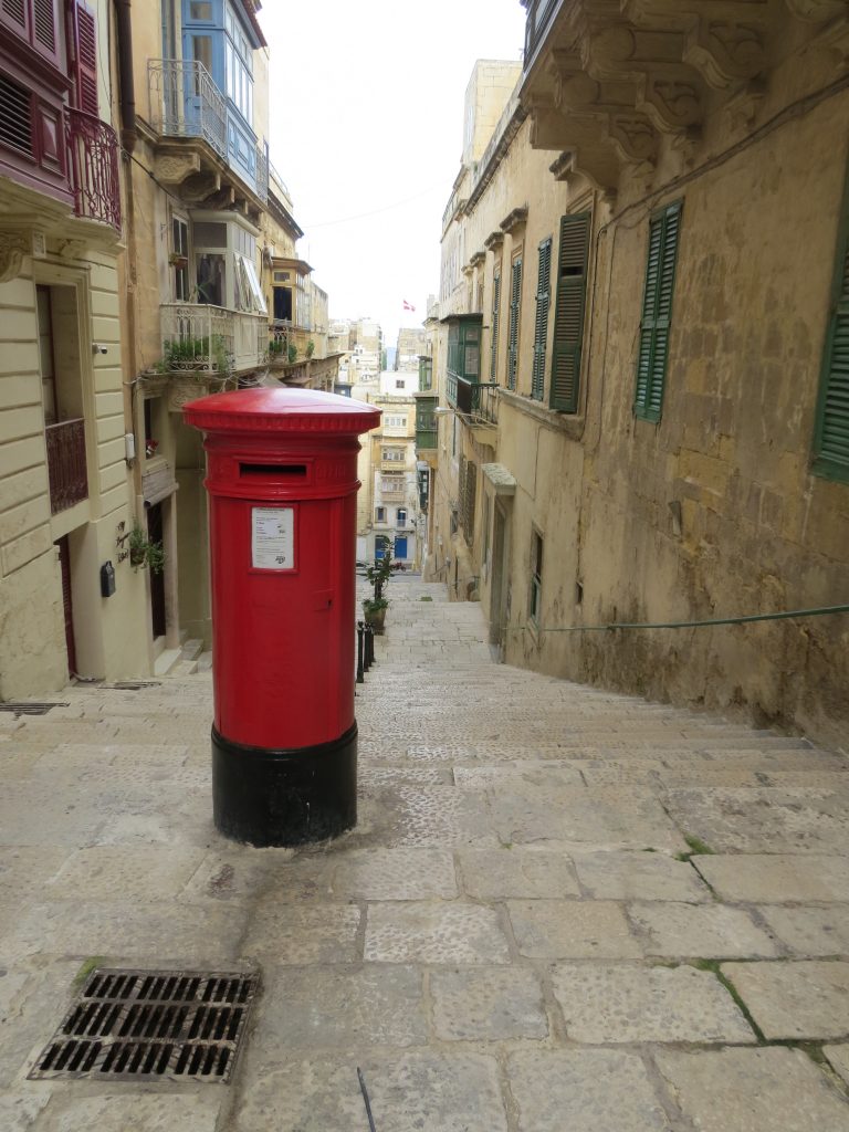
The main advantages to the British traveller is that English is widely spoken, being an official language with 88% of Maltese people speaking it and they also drive on the left. The majority of road signs are the same as found in the UK and all written road signage is in dual languages making it easy to explore the islands. There is an efficient public bus service on Malta and Gozo, it is another good way to get around as the buses go practically everywhere and are inexpensive. Red telephone and post boxes are scattered across the islands are another reminder of the British connection.
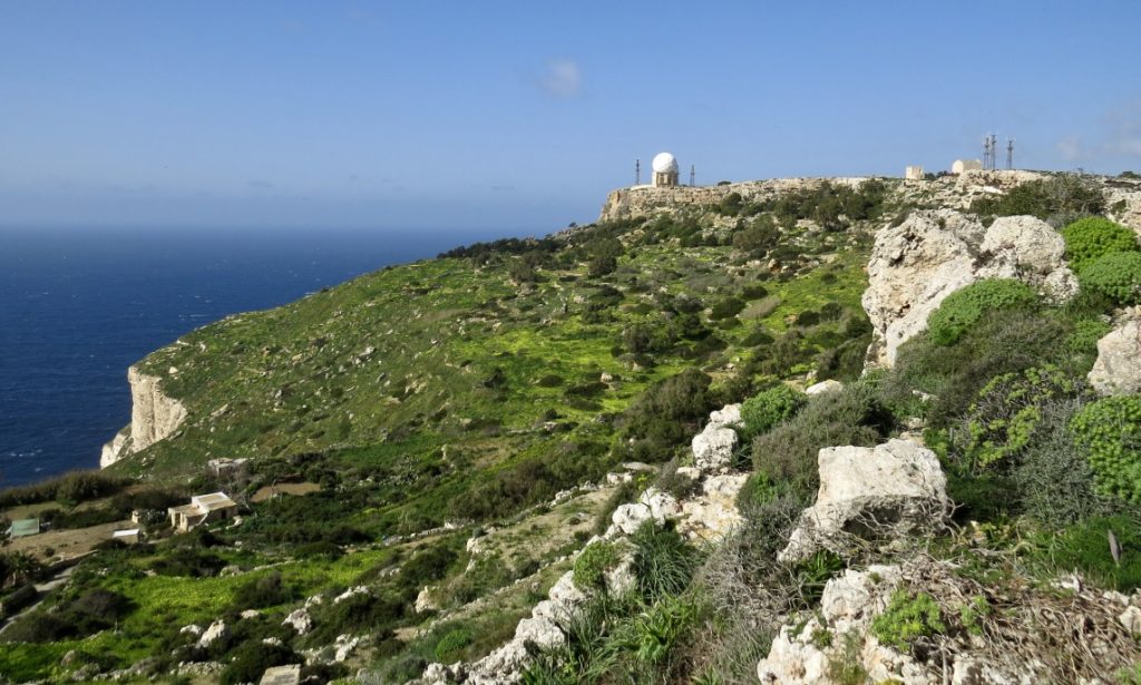
The beautiful Dingli Cliffs lay on the western coast and are the highest point of the islands around 250m above sea level. There is a tiny chapel perched on the very edge, dedicated to St Mary Madgalene, and a large radar system known as the observatory because of its distinctive “golf ball” shape. The tiny island of Filfla lays off the coast, its size was greatly reduced by the Royal Navy and Air Force using it for target practice. Not far from the cliffs is Misrah Ghar il-Kbir or informally known as Clapham Junction, an area of paired grooves carved into the limestone pavement presumed to be cart ruts. Here the oldest geocache in Malta can be found.
GCHEQ7 The Ring of Clapham Junction by lucentio (adopted by Gremxul) traditional D2.5/T2 4.1.2004
Nearby to the cart ruts is the natural depression of Għar il-Kbir, forming a cave complex of interconnecting caves, which was inhabited by people from Neolithic times till 1835.
Another historic site worth visiting is the megalithic temples of Ħaġar Qim and Mnajdra they are the best preserved of Malta’s prehistoric sites. A visitor centre and permanent tentlike canopies have been erected over the complex to protect the temples from the elements. The temples are in solar alignment so at each of the equinoxes the sun shines on the furthest edge of a slab inside the temples.
GC7B8NZ Mnajdra and Ħaġar Qim by Jovaluda Virtual D1/T2
Gozo
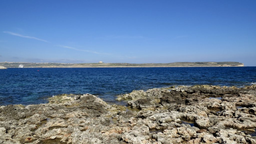
We recommend taking the ferry to Gozo, it takes just 20 minutes, the ferries are very frequent and cheap. The car ferry shuttles between Malta’s Ċirkewwa and Gozo’s Mġarr every 45 minutes from 6am to around 6pm and roughly every 1½ hours throughout the night. If travelling by vehicle you pay on your return leg, when leaving Mġarr, so there’s no need to buy a ticket in Ċirkewwa on the way out. One of the highlights of our trip to Gozo was the salt pans and discovering this earthcache:
GC5MXE1 Salt Pans from Zebbug and Marsalforn by Hatamoto-Skyks Earthcache D1.5/T2
Useful Information
Currency is the Euro Electricity is 230 Volts, 50Hz. Plug type G 3-pin plug as in the UK Flight Time from Manchester 3 hours 25 minutes Time Zone I hour ahead of UK
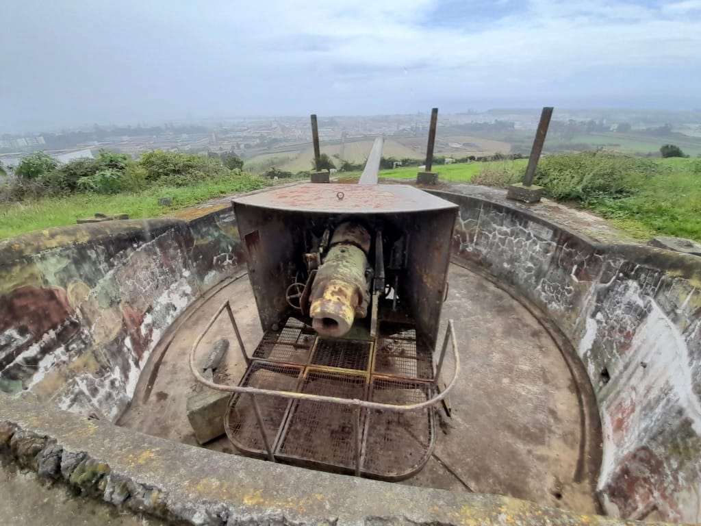
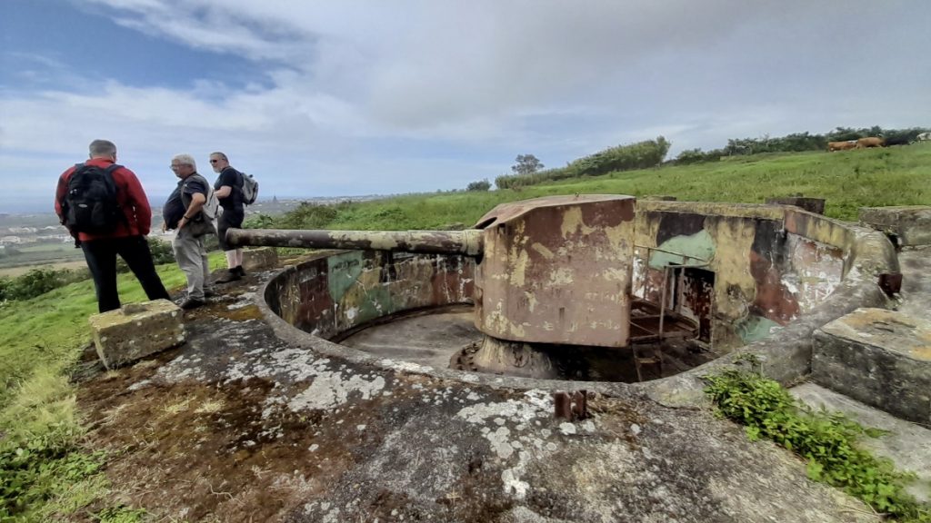
GC7ZR5T JOKER PDGT – COASTAL WATCH – P. Delgada CANONS by PALHOCOSMACHADOD D5/T4
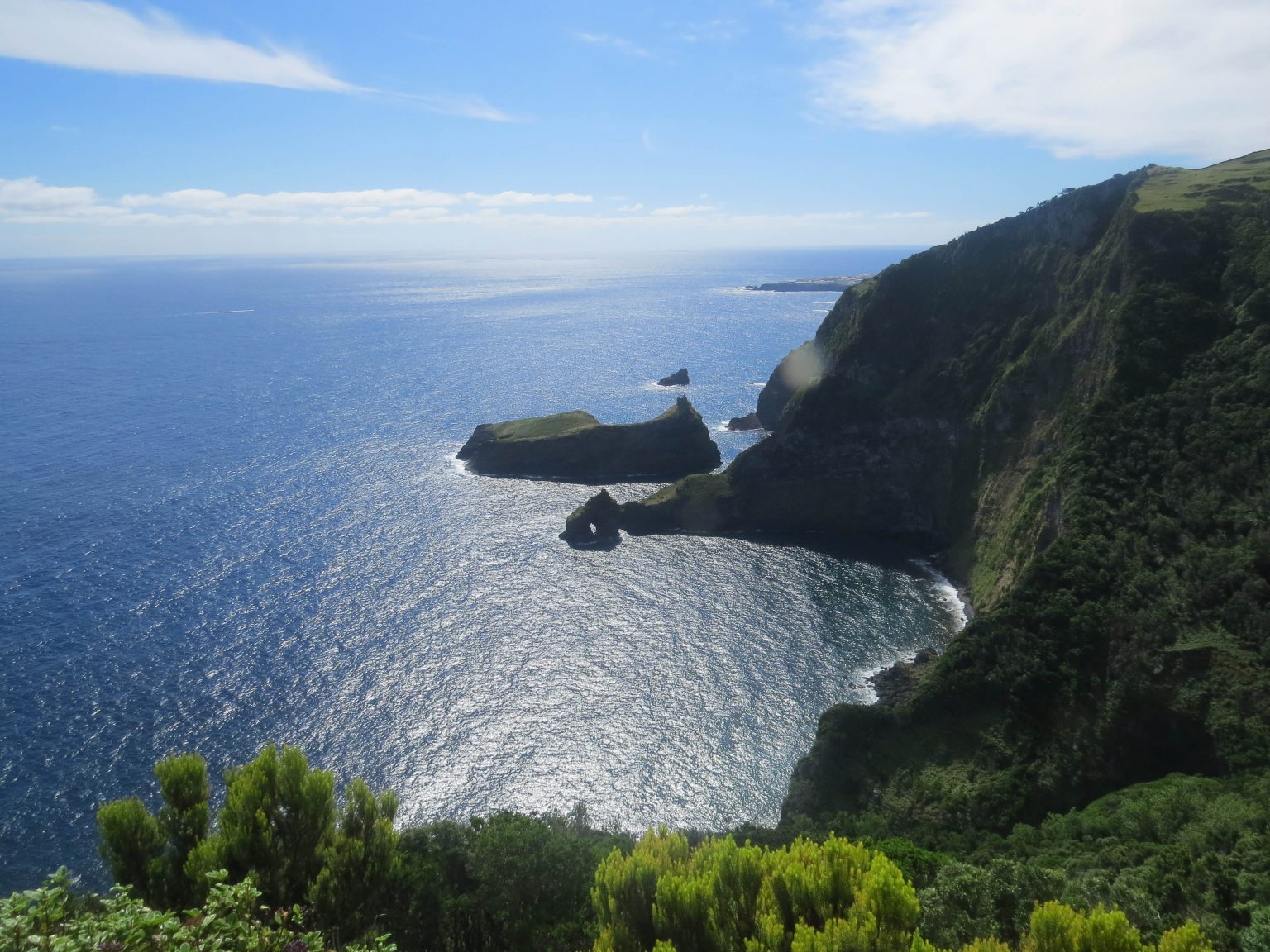
This letterbox cache explores a WWII defence post high on Pico da Castanheira over looking the city of Ponta Delgada and its harbour. Portugal was neutral throughout the war but the Azores Islands laying in the middle of the Atlantic Ocean, 870 miles west of Lisbon and 1,200 miles southeast of Newfoundland, Canada were strategically very important to both sides.
The CO pointing out the importance of the guns siting in relation to the harbour
After meeting the cache owner, Luis, at an event we took up his kind offer for a guided tour of this fascinating place. The three guns are all still in situ and in remarkable condition seeing they have been in place since 1940 with no maintenance since 1969 when operations here ceased.
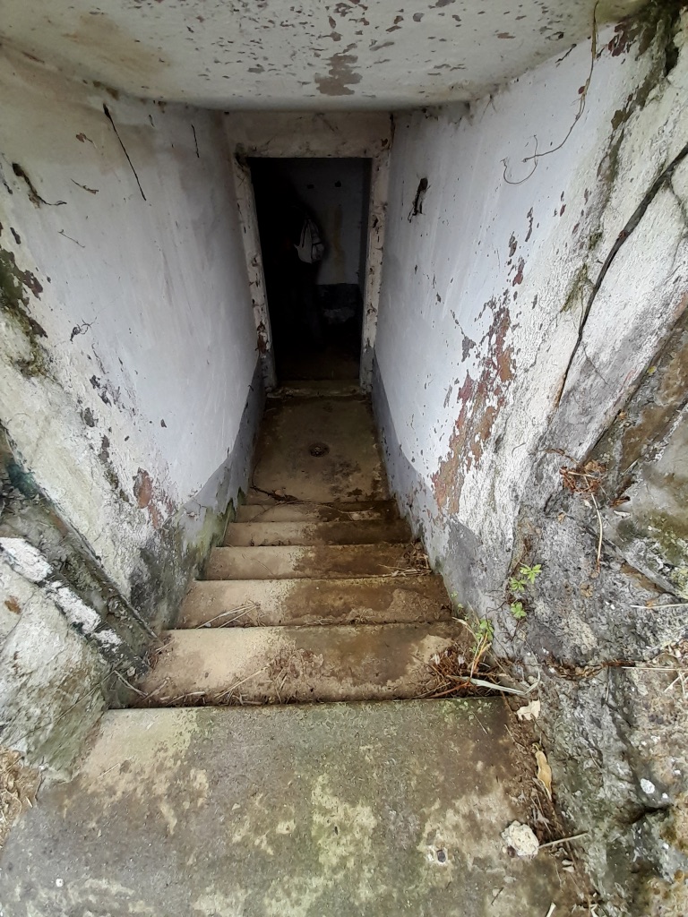
Into the tunnels
On the cache page there is a map of the underground tunnels and rooms, it is advisable to bring a copy, as well as studying the attributes. The condition of the tunnels is remarkable, no sign of damp and seeing they are open to all there is no vandalism or graffiti.
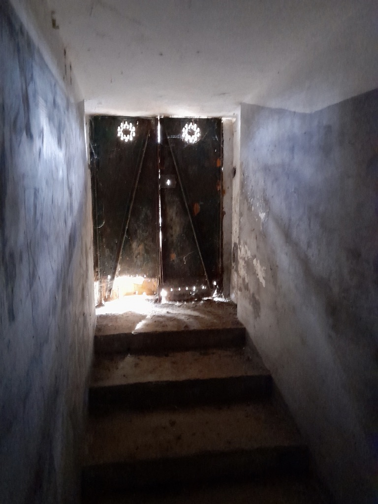
The doors lead to one of the gun emplacements
The hunt for the coordinates of the final hide guides you around the battery exploring the different rooms and tunnels. As with all military establishments your rank determined conditions and facilities, with the Battery Commanders having proper toilets!
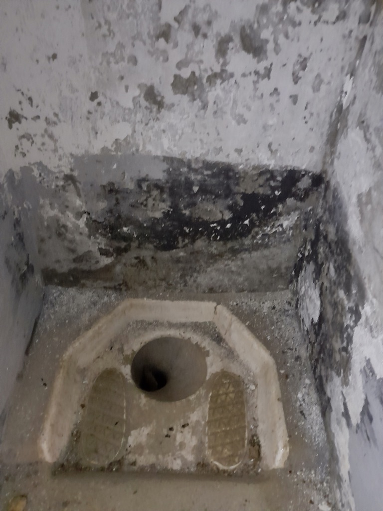
A latrine for the lower ranks
The tunnels eventually lead to the underground observation post which would have been manned at all times, here there was a machine gun, only the concrete mount remains today. All defences of the battery were positioned for a seaward attack.
View of the sea and Ponta Delgada from the observation post.
This is another one of those places that we would never have known existed let alone visited if it had not been for Geocaching. Having Luis as a guide with his knowledge of the history of the fortifications added to our understanding of how it operated and its position strategically.
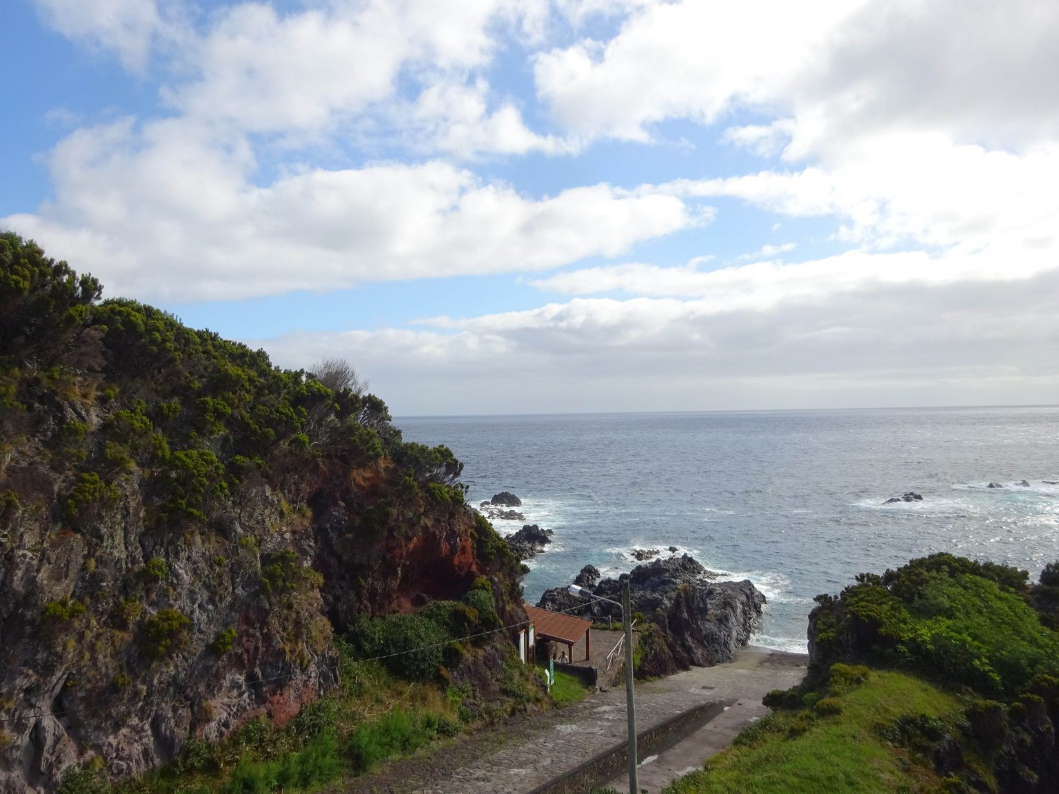
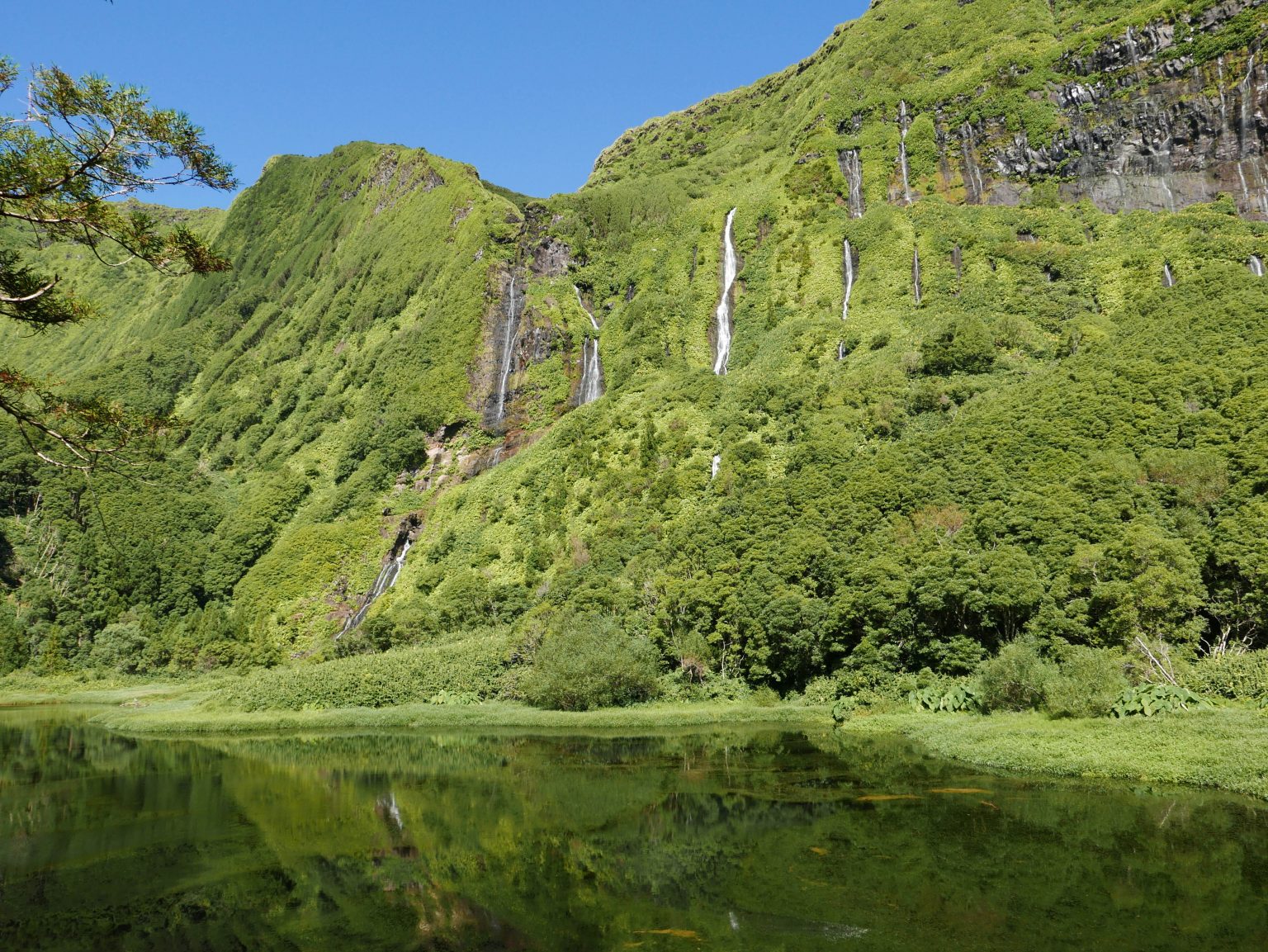
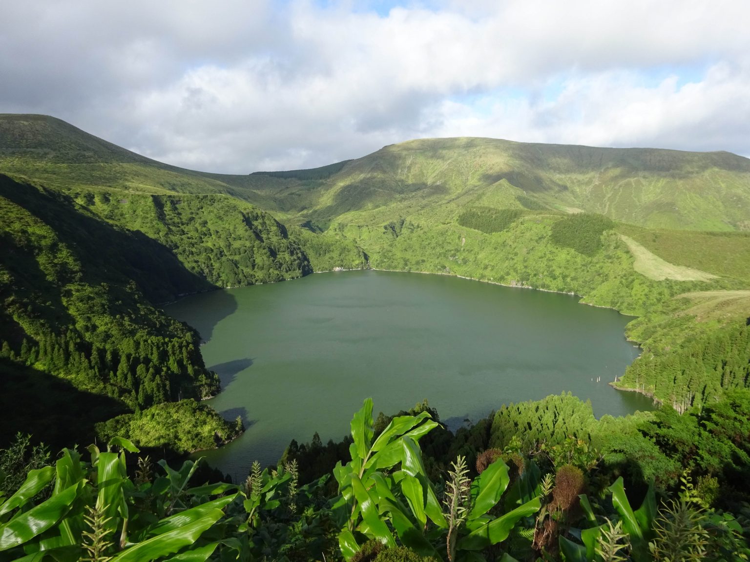
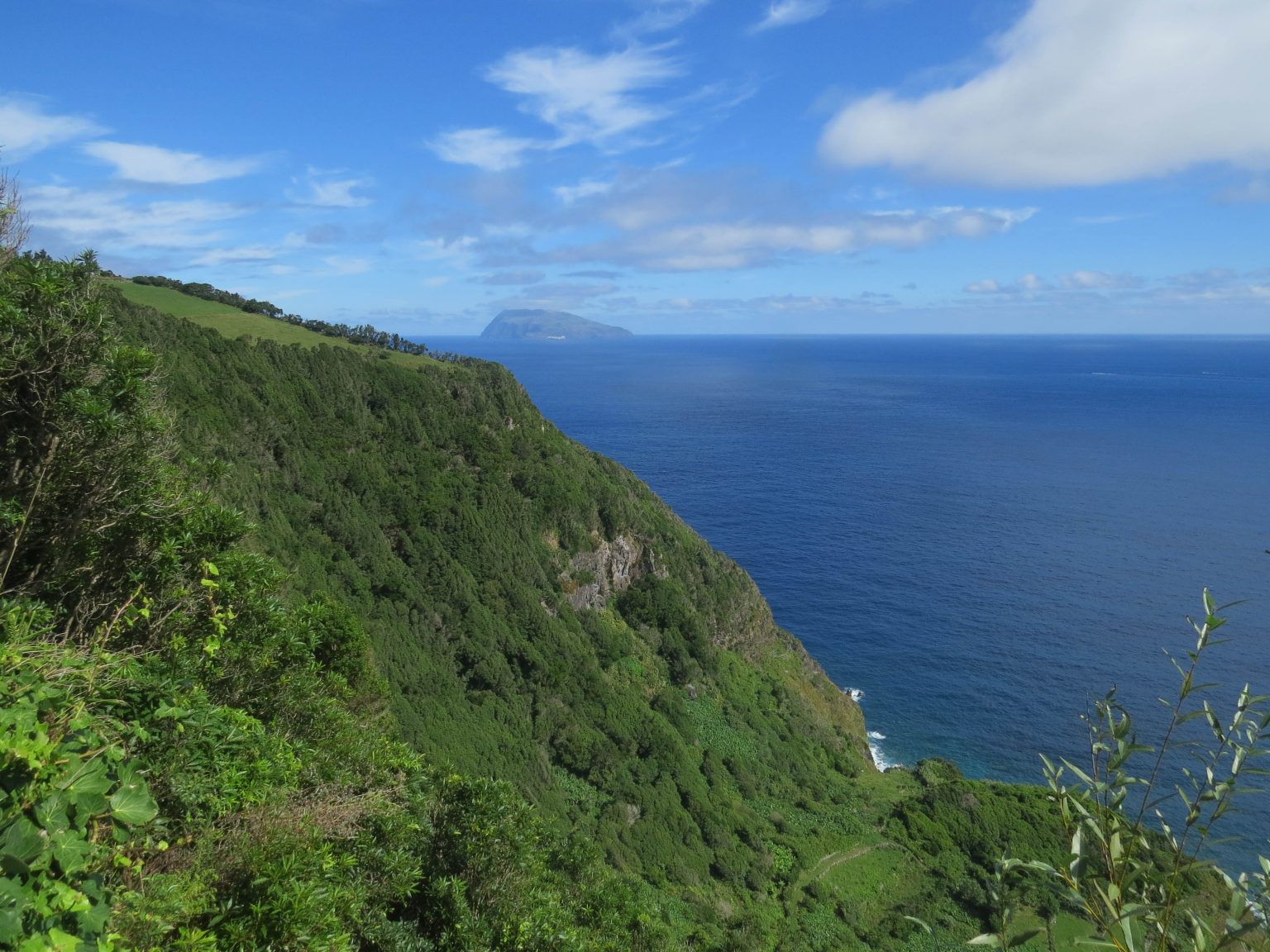
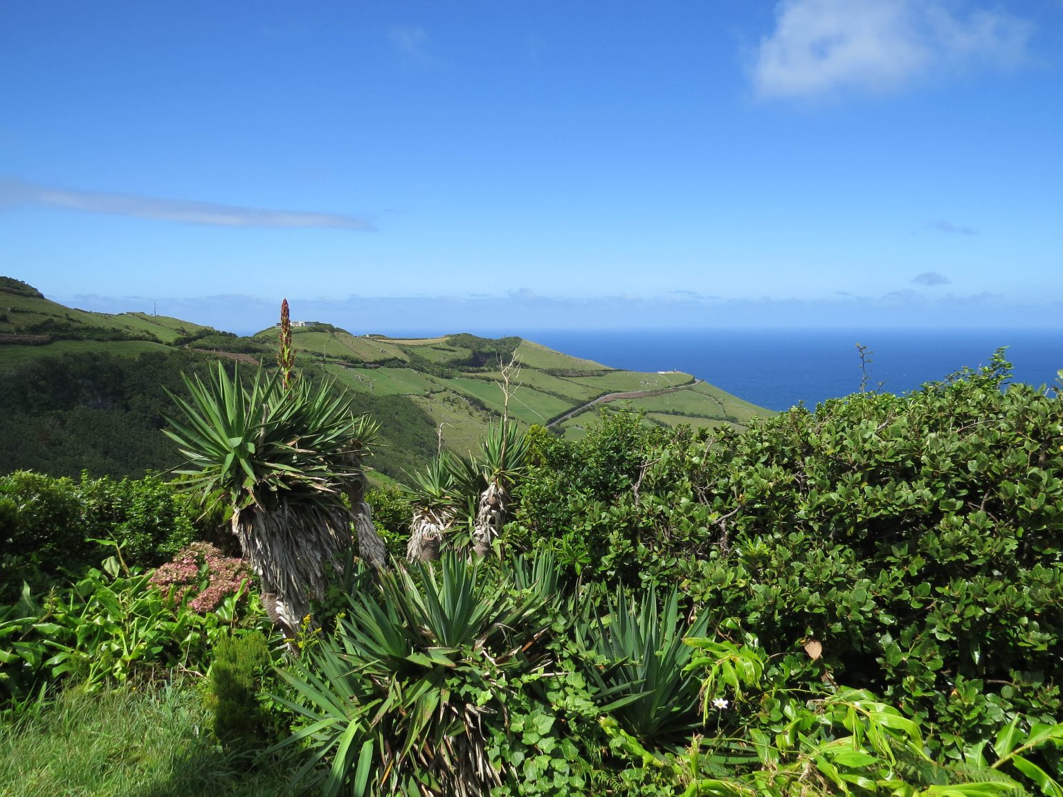
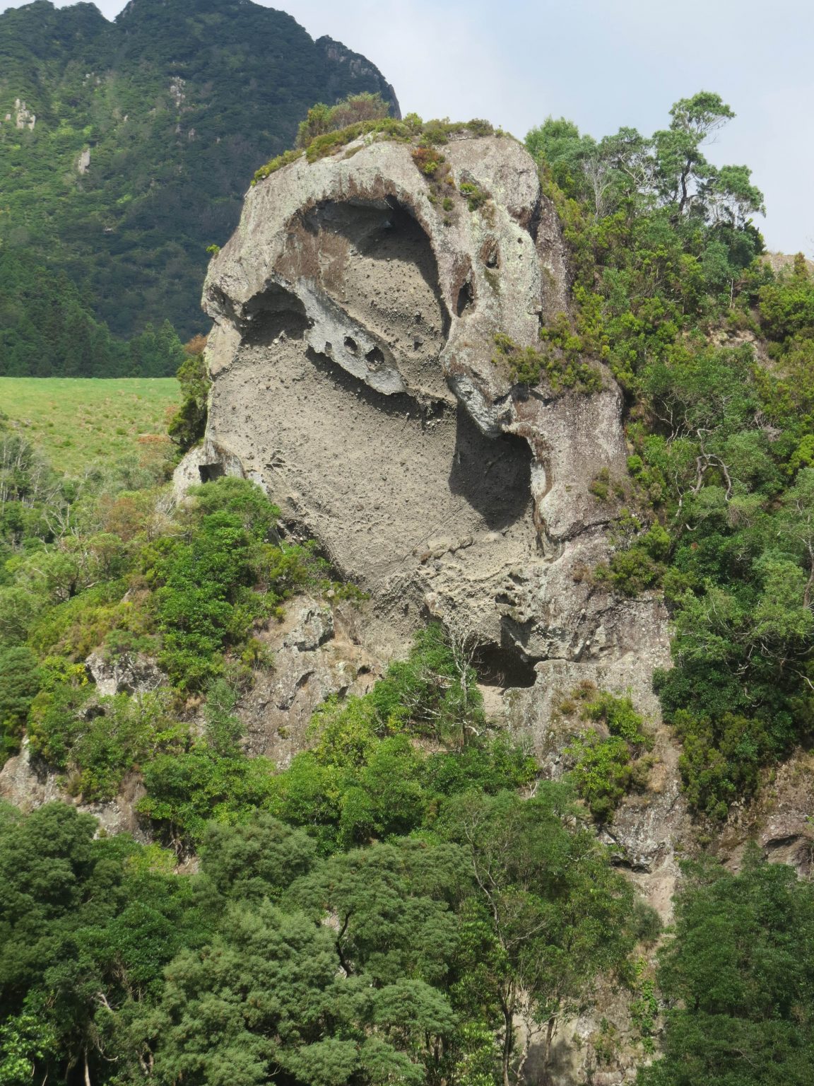
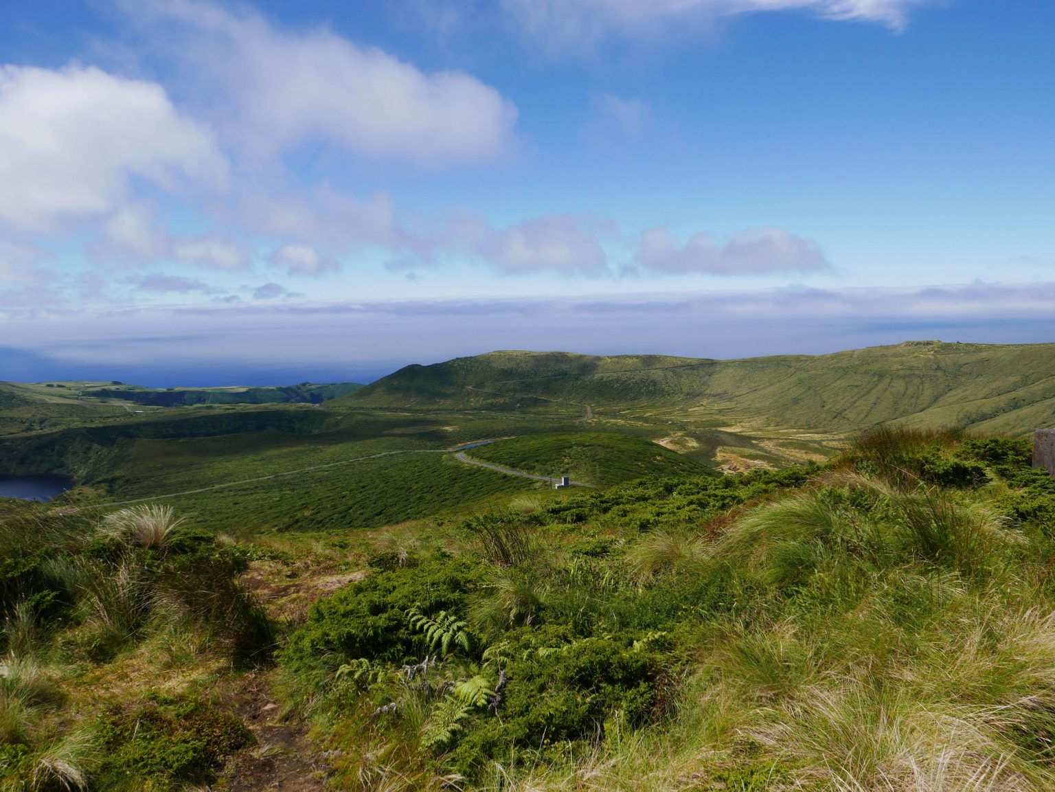
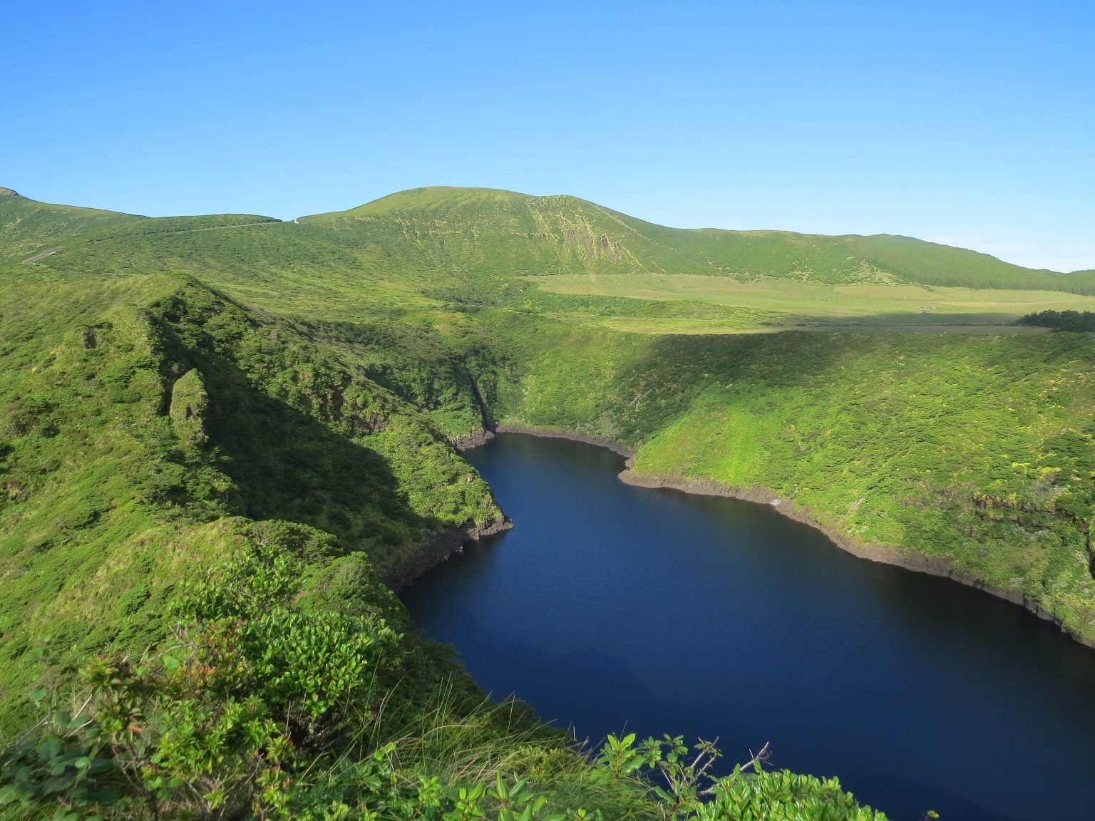
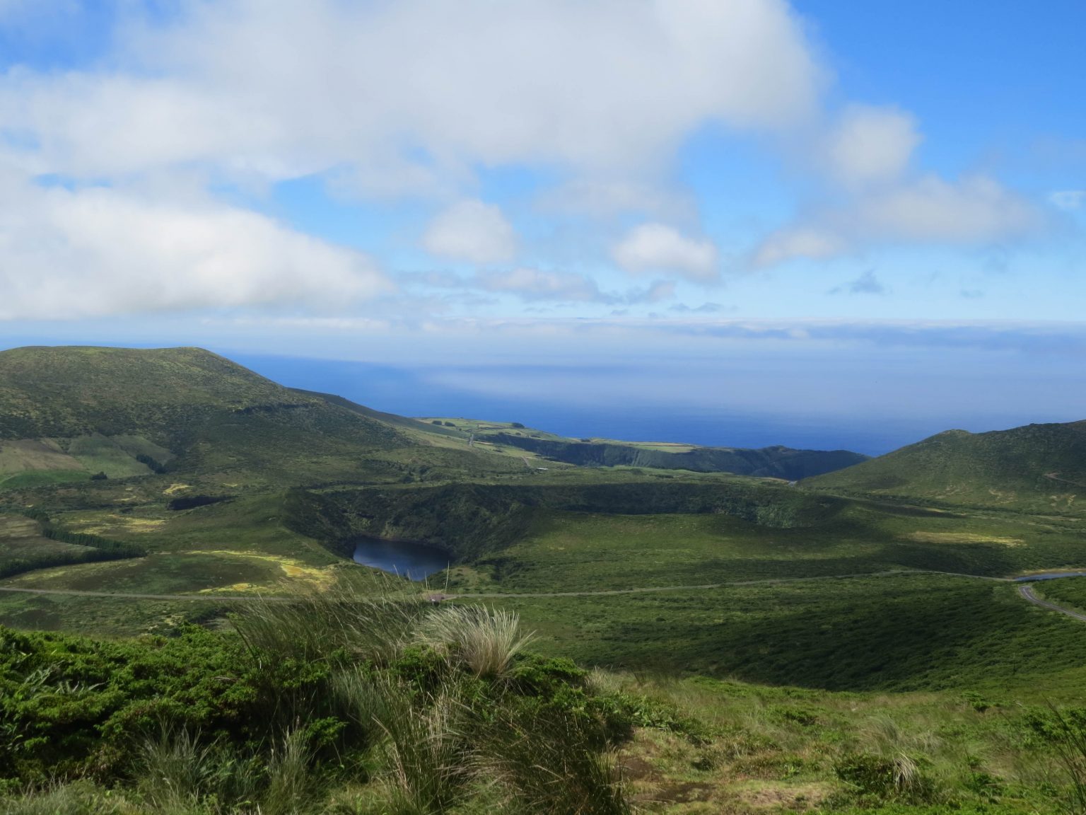
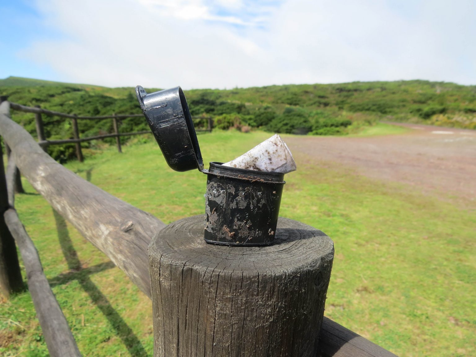
After five and a half years planning we are here in Flores, the most westerly point of Europe, surrounded by the Atlantic ocean, next stop the USA. The scenery is truly amazing and we find ourselves repeatedly exclaiming WOW. With Waterfalls over half a kilometre high and volcano calderas two a penny here it’s hard to describe the beauty. Geocaches however are a contrast often a small fragile plastic bottle from a popular local non alcoholic drink being abandoned in strategic locations, without the respect of private property or stone walls. Our lack of Portuguese is a handicap even with google translate often the text and hint are often incomprehensible.