There are no new caches to report, just a couple of event reminders:
Event Reminders
GCBYXNN 9 Usual Suspects – Nosh & Natter 94 by 9 Usual Suspects Event D1/T1
When: Thursday 29th October, 2026
Where: Snowdonia Parc, Waunfawr, Caernarfon, Gwynedd LL55 4AQ
Time: 7pm to 9pm or when the last person leaves

GCBXR3T Happy Halloween 2026 by 9 Usual Suspects Event D1/T1.5
When: Friday 30th October
Where: Plas Gwernoer, Nantlle LL54 6BB
Party Starts: 5pm
Party Ends: 8pm or when the last person leaves
Attire: Optional Halloween Fancy dress
Lets hope the weather God looks favourably on us, we really don’t need strong winds and rain. But whatever the weather brings we will be going ahead with this event.
The newly refurbished bar will be open and hot food will be served. All refreshments are free. To aid us with planning and catering for the evening, please could you make sure you have logged a ‘will attend’ including number of persons in your party.
For the very hardy we have very basic camping available and space for the odd caravan/motorhome, please message us for details.
The Beaufort Scale of Wind
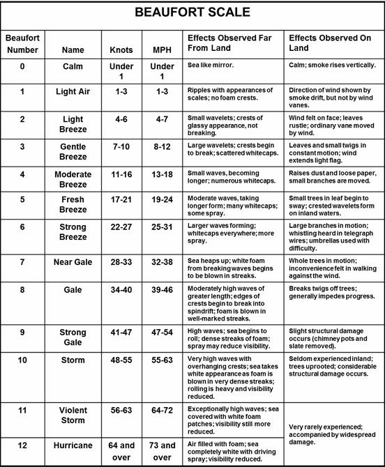
With our recent weather we thought it would be of interest to take a look at the Beaufort scale of wind Speed.
In 1805 Commander Sir Francis Beaufort published a method of measuring the wind at sea based on what sails a frigate could safely hoist. He was applying not simply his own observations but those of seafarers from centuries before him. The key difference was his scientific methodology. With each increment of the Beaufort Scale, as it was later to be known, there were descriptions of the state of the sea and the wind speed in knots (later convertible to m/h and km/h). From this standardised recording sailors were able to predict how ships would react in certain wind speeds.

Much later the Beaufort Scale was adapted for use on the land. The descriptions that go with it are still useful today. The link between what is observable and what has been measured (i.e. the wind velocity or force) allows a person to make predictions – about the need to take shelter, about the risk, etc.
More Beaufort numbers, those from force 13 to 17, were added by the United States Weather Bureau in 1955 to account for the winds that can occur during a hurricane, through to all intents and purposes once at force 12 or beyond, a ship’s, or a person’s options are very limited indeed.
The scale is an invaluable reference, worth learning and practising in the field or at sea.
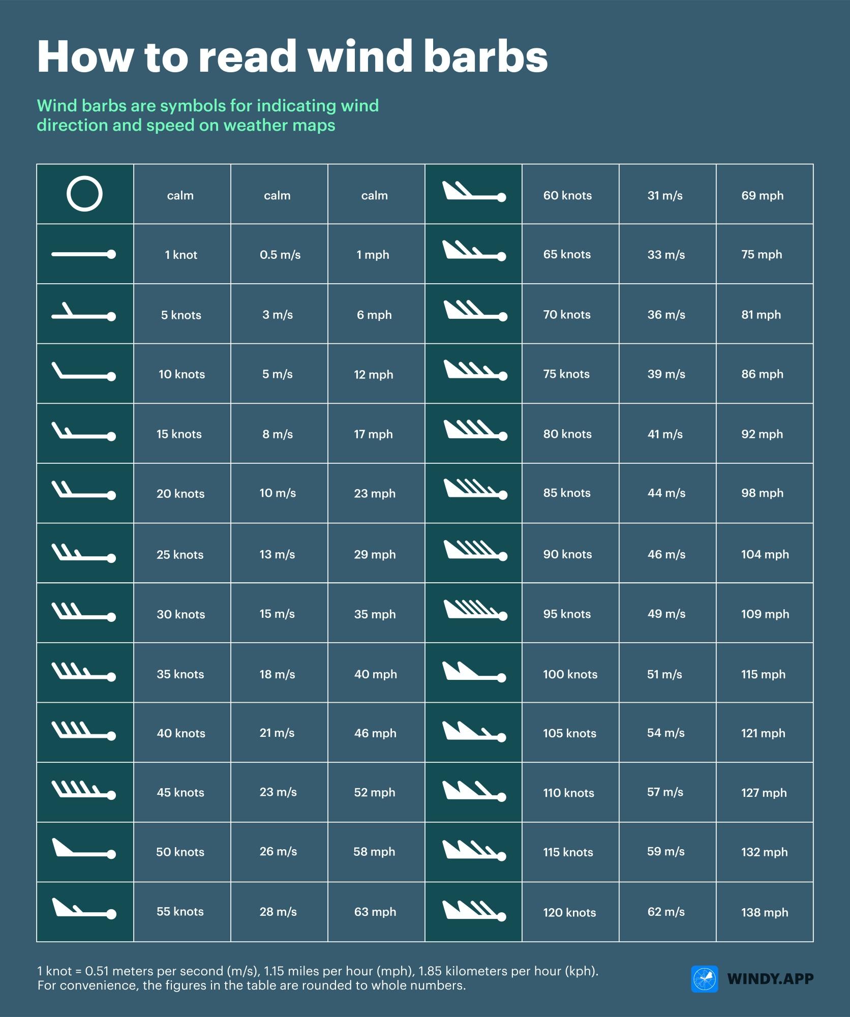
Wind barbs are used on some weather maps to indicate predicted wind speed: